Three Tropical Cyclone Seeds Active, BMKG Warns of Potential Extreme Weather Over the Coming Week
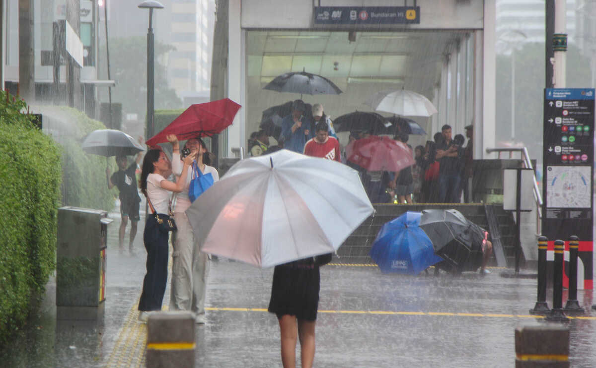
The Indonesian Agency for Meteorology, Climatology and Geophysics (BMKG) has forecast potential extreme weather in several parts of Indonesia over the coming week as three tropical cyclone seeds in the southern region become active. The period covered is 6-12 March 2026. In its weekly weather outlook released on Thursday 5 March, it recorded heavy rainfall in several areas during 2-4 March 2026, including Central Java with rainfall reaching 77.2 mm per day, East Java 72.5 mm, West Sumatra 67.5 mm, East Nusa Tenggara 63.2 mm, Jambi 57.5 mm, and West Java 53.1 mm.
BMKG explained that the high rainfall intensity results from interactions of multiple atmospheric dynamics, including the existence of three tropical cyclone seeds in the south of Indonesia (90S, 93S, 92P), the meeting of monsoon winds from the north with cross-flow from the Indian Ocean in the south, Madden-Julian Oscillation (MJO) in its phase 5 (Maritime Continent), and the active Equatorial Rossby and Kelvin waves.
BMKG predicts that in the coming week atmospheric dynamics from global to local scales will continue to influence Indonesia’s weather. The Asian monsoon is expected to strengthen, while the cold surge phenomenon is also forecast to be significant in the coming days.
Seed 90S is forecast to be in the southwestern Indian Ocean south of East Java with maximum wind speed 35 knots and minimum central pressure 998 hPa, moving eastward. In the next 48-72 hours, this system is expected to weaken but still trigger the formation of a low-level jet in the southern Indian Ocean south of East Java to south-west Nusa Tenggara and create convergence and confluent zones from the southern coast of Banten to south NTB.
Seed 93S is forecast to be in the waters off western Australia with max wind 25 knots and pressure 995 hPa moving west to south-west. In two to three days, the intensity is predicted to be moderate.
Meanwhile, tropical cyclone seed 92P is forecast to be in the Gulf of Carpentaria with wind max 15 knots and pressure 1004 hPa, moving west to west-south-west and expected to weaken within 48-72 hours. This system triggers a low-level jet in the Gulf of Carpentaria as well as a convergence zone from the Timor Sea to the southern Arafura Sea.
Besides tropical cyclones, Madden-Julian Oscillation (MJO) is predicted to remain in phase 5 or Maritime Continent in the coming week. This condition could strengthen cloud formation in eastern Indonesia.
Rain potential also reinforced by Kelvin waves in Aceh, North Sumatra, southern Kalimantan, North Sulawesi, North Maluku and parts of Papua north; while Equatorial Rossby waves active in southern West Nusa Tenggara, southern East Nusa Tenggara, Maluku and almost all Papua.
Between 6-8 March 2026, weather generally light to moderate rain; but there is potential for moderate to heavy rainfall in some areas including North Sumatra, West Sumatra, Riau, Jambi, South Sumatra, Bengkulu, Lampung, Bali, most of Kalimantan, Sulawesi, Maluku, and Papua.
BMKG also issued an early warning category alert for potential heavy to very heavy rain in Bangka Belitung Islands, Banten, Jakarta, West Java, Central Java, DI Yogyakarta, East Java, West Nusa Tenggara, and East Nusa Tenggara. Wind gusts expected in West Java, Central Java, DI Yogyakarta, East Java, Bali, NTB, NTT, Maluku, and South Papua.
Entering 9-12 March 2026, light to moderate rain still possible; but moderate to heavy rainfall expected in Aceh, North Sumatra, West Sumatra, Riau Islands, Jambi, South Sumatra, Bangka Belitung, Bengkulu, Lampung, Banten, Jakarta, West Java, Central Java, DI Yogyakarta, Bali, West Nusa Tenggara, East Nusa Tenggara, several parts of Kalimantan, Sulawesi, Maluku and Papua.
During this period, BMKG sets an alert status for heavy to very heavy rain in East Java, East Nusa Tenggara, and South Sulawesi. Winds gusts expected in Central Java, DI Yogyakarta, East Java, Bali, NTB, NTT, Maluku, and South Papua.
BMKG urges the public and stakeholders to heighten vigilance against extreme weather that can trigger hydrometeorological disasters such as floods, landslides and strong winds. The dynamic weather should be considered in planning activities, especially road, sea, air travel and outdoor activities.
People are reminded to regularly monitor forecasts via official BMKG channels, including the official website, the InfoBMKG app, and the agency’s social media.