What is the Difference Between El Niño and La Niña? Understand Their Impacts on Indonesia
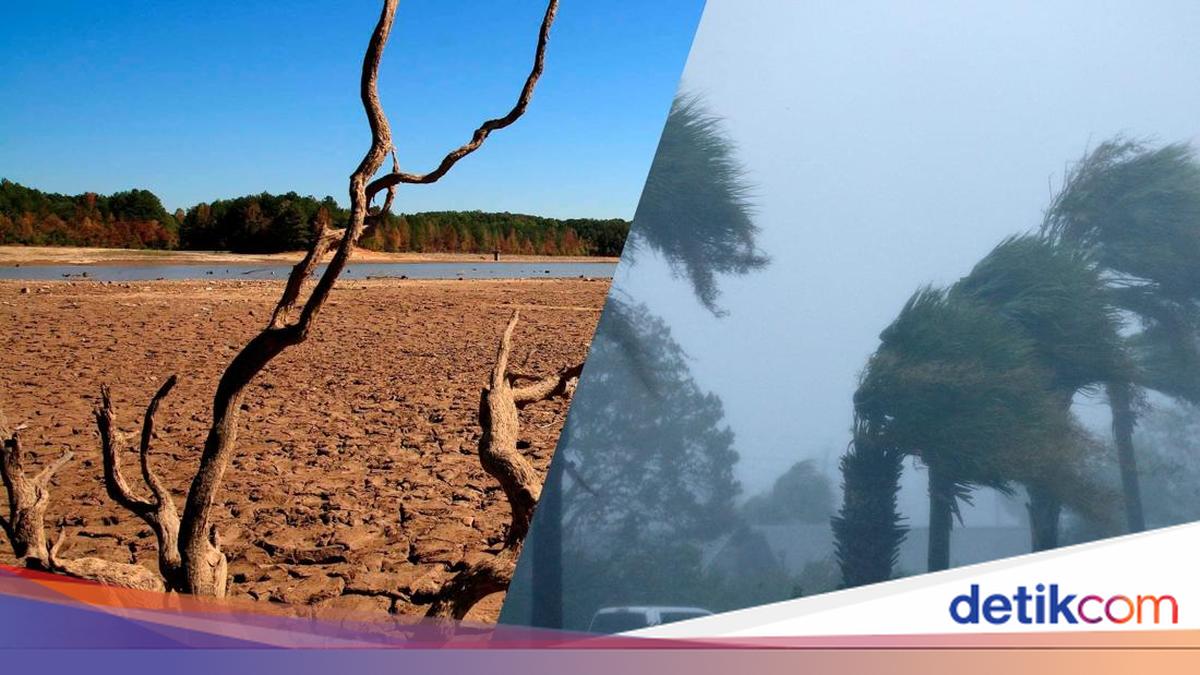
Global climate phenomena such as El Niño and La Niña often serve as the primary factors behind changes in Indonesia’s weather patterns. These two phenomena not only affect sea surface temperatures but also have widespread impacts on rainfall and seasons in Indonesia. Despite having similar names, they are frequently misinterpreted as the same; in fact, El Niño and La Niña are opposing phenomena, both in definition and in their effects on Indonesia. So, what are the differences between El Niño and La Niña? To find out, consider the following information, compiled by detikJogja from the BMKG website, the BRIN website, and the Ministry of Health website. Differences Between El Niño and La Niña The main difference between El Niño and La Niña lies in the sea surface temperature conditions in the Pacific Ocean. El Niño is characterised by an increase in sea surface temperatures or conditions warmer than usual, whereas La Niña is marked by a decrease in sea surface temperatures to cooler than normal levels. These temperature differences affect wind patterns and atmospheric circulation, ultimately impacting rainfall distribution in various regions of the world, including Indonesia. During El Niño, Indonesia tends to experience a decrease in rainfall, making the dry season feel longer and drier. Conversely, during La Niña, rainfall increases, so the rainy season can last longer or be more intense. In other words, El Niño is synonymous with dry conditions, while La Niña is synonymous with wet conditions. This difference is the key to understanding how these phenomena affect Indonesia’s climate. Causes of El Niño and La Niña The occurrence of El Niño and La Niña is inseparable from the dynamics of sea surface temperatures in the eastern and central Pacific Ocean. These temperature changes are closely related to the strength of the trade winds blowing from east to west around the equatorial region. El Niño occurs when the trade winds weaken, causing the warm seawater that usually accumulates in the western Pacific to shift towards the centre and east. As a result, sea surface temperatures in those areas rise, triggering global weather pattern changes. Conversely, La Niña occurs when the trade winds strengthen, pushing more warm water to the western Pacific and causing cooling in the central to eastern regions. This condition is usually accompanied by changes in the Walker Circulation, which plays a role in regulating global weather patterns. These phenomena can occur periodically every few years and last for varying durations, from several months to two years. Their intensity can also differ, from weak to strong, which naturally affects the magnitude of the impacts produced. Impacts of El Niño on Indonesia El Niño causes a decrease in rainfall in Indonesia. During the June-July-August (JJA) and September-October-November (SON) periods, almost all regions experience a significant reduction in rain. Then, in the December-February (DJF) range, the impact of the reduction is more pronounced in central and eastern Indonesia, while in March-May (MAM), the effects vary. The impacts are not limited to reduced water but also trigger widespread forest and land fires. Additionally, prolonged drought affects the agricultural sector, the economy, and social conditions of the community. Does Rain Occur During El Niño? Many assume that during El Niño, rain will disappear entirely. However, this assumption is not entirely accurate. El Niño does cause a substantial decrease in rainfall, even exceeding 40% in certain periods such as June-August and September-November. Nevertheless, rain can still occur in some regions, especially during December-February and March-May. This means El Niño only reduces the intensity and frequency of rain, not eliminates it completely. This situation still needs to be monitored because significant rainfall reduction can trigger drought. Impacts of La Niña on Indonesia The impacts of La Niña in Indonesia are generally in the form of a significant increase in rainfall. During the June-July-August (JJA) period, almost all regions of Indonesia experience increased rain. Then, in September-October-November (SON), the rainfall increase is more felt in central to eastern Indonesia. Meanwhile, during December-January-February (DJF) and March-April-May (MAM), the rainfall increase mainly occurs in eastern Indonesia. In general, rainfall during La Niña can increase by around 20-40% compared to normal conditions, even higher in certain areas. This increase in rainfall certainly brings risks of hydrometeorological disasters, such as floods, flash floods, landslides, strong winds, and tropical storms. It even affects the agricultural, fisheries, and marine ecosystem sectors.