The Situ Gintung Tragedy 2009: 17 Years of Reflection, Between Grief and Ecological Learning
On the morning of Friday, 27 March 2009, the Situ Gintung embankment collapsed, marking a dark chapter in the spatial planning history of the Jakarta metropolitan region. The disaster was not merely an infrastructure failure, but a stark warning about the fragility of the balance between human settlement and environmental carrying capacity.
As a witness and coordinator of the disaster response at the time, there is a moral imperative to ensure that this “memorial monument” translates not merely into stone, but into preventive policies. The land tsunami that struck in the early morning hours claimed nearly 100 lives. The memories of panic, the profound grief of bereaved families, and the solidarity of volunteers working through the mud serve as reminders that behind every disaster statistic lies a life, a future, and shattered families. Revisiting these memories is not about reopening old wounds, but about maintaining collective vigilance against fading awareness.
The most significant technical lesson from Situ Gintung is the importance of Integrated Environmental Audit:
• Land-Use Conversion: Massive population pressure transformed the water body’s buffer zone into dense residential areas.
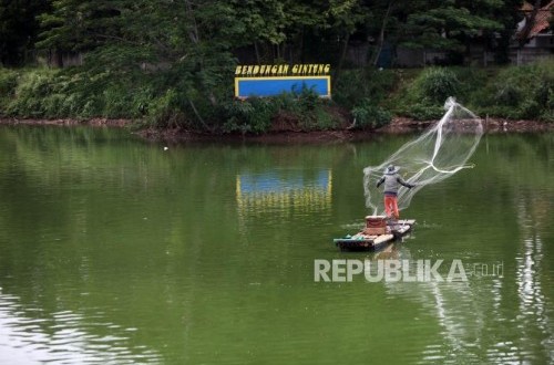
• Structural Integrity: The reservoir, built during the colonial era (1933), had exceeded its design capacity without proportionate structural reinforcement to match modern environmental pressures.
• Disaster Literacy: The absence of an effective early warning system left residents without sufficient evacuation time when water levels surpassed critical thresholds.
The principle of “One River, One Plan, One Integrated Management” is central to preventing future disasters. Rivers, reservoirs, and lakes cannot be managed in isolation or based solely on administrative boundaries. Situ Gintung, located in South Tangerang, had regional impacts that devastated the Pesanggrahan River and ultimately reached Jakarta Bay.
Integration must connect upstream to downstream: water management across the Jakarta metropolitan region requires a unified hydrological systems approach. Additionally, modern technology must be married with local knowledge—combining satellite monitoring systems with communities’ ability to read natural warning signs.
The disaster necessitates a transformation from reactive “firefighting” management to proactive risk management. Normalisation and revitalisation must redefine reservoirs not merely as water storage facilities, but as public spaces and ecological buffers with inviolable boundary zones free from construction. Cross-sectoral coordination spanning central government, regional authorities, and grassroots communities remains the essential key to minimising future disaster impacts.