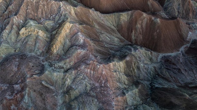
The Arabian Plate: Why Is It "Destined" to Be the World's Secret Hydrocarbon Repository?
Jakarta, CNBC Indonesia - The Middle East region consistently maintains its position as the primary hub in the global energy supply chain. This strategic role is based on the geological characteristics of the region that allow for the accumulation of massive hydrocarbon reserves.
With the increase in global energy demand and the transition towards more measured resources, the oil and gas industry’s focus is beginning to adjust.
Operations that were previously centred on exploiting shallow rock formations are now gradually shifting towards deep gas exploration in much older stratigraphic layers.
This shift in focus is a proactive step to maintain the balance of global energy supply in the future, given that current shallow reserves are projected to be insufficient to meet long-term demand projections for the industrial and transportation sectors in various countries.
Dominance of the Arabian Plate in Global Supply
The main structure supporting hydrocarbon production in the Middle East is the Arabian Plate. Currently, the region contributes around 30% of total world oil production and 17% of global natural gas production.
This landmass plate has a physical area exceeding one million square miles and geologically holds 55% of total proven oil reserves as well as 40% of world natural gas reserves.
Above this expanse of the plate, there are also 25% of the total giant oil and gas fields worldwide. Geographically, the boundaries of the Arabian Plate are marked by the waters of the Red Sea, the Zagros Mountains, the Indian Ocean, and the Mediterranean Sea.
Geological history records that this plate separated from the African Plate about 25 million years ago, then slowly moved north until it eventually collided with the Eurasian Plate and formed the folded belt of the Zagros Mountains.
It is in this plate region that the first commercial hydrocarbon production was officially recorded in 1908 at the Masjed Soleyman field in Iran.
Dynamics of Cross-Border Gas Fields in the Khuff Formation
One of the most significant energy assets on the Arabian Plate is the South Pars or North Dome gas field. This geological structure straddles the maritime border between Qatar and Iran.
The natural gas in the field is safely stored within the Khuff Formation, a porous and permeable rock layer formed about 200-300 million years ago during the Permian and Triassic periods.
This reservoir rock formation is located at a depth of nearly two miles below the seabed. For the Qatari government, managing the North Dome area facilitates a daily gas production rate of around 18.5 billion cubic feet.
This production figure makes Qatar one of the world’s largest liquefied natural gas exporters, with revenue dominating the country’s fiscal receipts structure.
Meanwhile, Iran manages the South Pars section of the field with a production capacity of around 2 billion cubic feet per day. The produced gas is specifically allocated to meet domestic energy needs and exported through commercial pipeline networks to neighbouring countries such as Turkey and Iraq.
Anticipating Deficits and Shifting Exploration Targets
Based on macroeconomic projection modelling, global energy demand is estimated to continue increasing until approaching 2050. Production levels from currently operating conventional gas fields are projected not to be able to keep pace with that demand trajectory in the long term.
The oil and gas fields operating in the Middle East currently mostly extract reserves from shallow earth layers formed in the Mesozoic and Cenozoic geological eras.
To anticipate a structural supply deficit in the global market, energy companies are beginning to direct exploration focus to ancient rock layers from the Paleozoic era, which are located much deeper underground.
In the Arabian Plate region, the main target for this deep gas formation is the Qusaiba Formation, which is an organic-rich shale layer from the early Silurian period.
This sedimentary layer acts as the primary source rock where organic material matures and transforms into hydrocarbons due to geothermal pressure and heat. The natural gas from the Qusaiba Formation then slowly migrates to fill the surrounding rock reservoir layers.
Mapping Subsurface Potential Zones
To accurately identify the location and distribution of deep gas reserves, the industry sector applies integrated cross-plate data screening methods. This technical analysis focuses on evaluating gas movement from the source rock area using hydrocarbon migration distance boundary parameters of up to eighty kilometres.
This observation method integrates various geological variables into a combined opportunity mapping model to determine zones with the highest probability of exploration success.
Through this spatial data approach, geological experts have identified six main exploration prospect paths spanning from the Paleozoic era to the early Mesozoic, namely the Qasim, Sarah, Jauf, Unayzah, Khuff, and Jilh Formations.
Further analysis of these prospect paths has resulted in more specific mapping of stacked potential zones on the Arabian landmass. The highest concentration of potential gas reserve formations has been identified around geological high structures such as the Qatar Arch and in rift basin boundary areas like the Palmyrides region.
Tectonic History and Reservoir Rock Quality
A comprehensive understanding of the hydrocarbon system on the Arabian Plate requires analysis of the tectonic evolution record of the region spanning nine hundred million years.
In the ancient geological era, the landmasses composing the Arabian Plate were still separated in the waters of the Mozambique Ocean before slowly uniting to form the supercontinent Gondwana.
Massive geological events that had a significant impact on the quality of reservoir rocks