Scientists Can Now Precisely Predict Where Thunderstorms Will Form
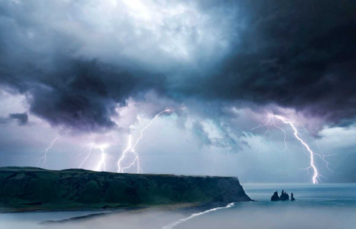
Thunderstorms in the hot late afternoon have long appeared suddenly, with no fixed location. But that uncertainty is set to end soon. A UK Centre for Ecology & Hydrology (UKCEH) study reveals subtle patterns in soil moisture and surface winds that can indicate where storm clouds are most likely to form.
The research, led by the UK Centre for Ecology & Hydrology (UKCEH), focuses on the early stages of storm development, when thunderstorm clouds grow rapidly within minutes, leaving little time for residents to react.
In the hot afternoon heat, storms develop very quickly. It takes less than 30 minutes for a cluster of clouds to develop into a major storm that brings heavy rain and lightning. This speed often makes early warnings feel vague until the last moments.
However, the study argues that storm triggers are not random. The researchers found that the interaction between soil-moisture patterns and winds in the lower atmosphere acts as a “steering wheel” that drives the location where storms occur.
Christopher Taylor, the study’s lead author from UKCEH, explains that the atmosphere responds not only to heat and moisture but also to small-scale differences at the surface. “Storms can appear abruptly, as if from thin air. Our research shows that where a storm is triggered is more predictable than previously thought,” Taylor said.
The research team analysed satellite data covering 2.2 million storms over 21 years (2004-2024) in the sub-Saharan Africa region. The scale of this study makes subtle signals easier to recognise.
A crucial technical finding is that when soil-moisture patterns align with wind direction (wind shear), the likelihood of explosive storms increases by up to 68%. Dry soil heats more quickly, while wet soil stays cooler; this temperature contrast drives rising air to form clouds.
Data from the World Meteorological Organization (WMO) records that between 2010 and 2019, lightning storms caused around 30,000 deaths and US$500 billion in economic losses globally.
Cheikh Abdoulahat Diop of Senegal’s national meteorological service said the findings are highly useful for densely populated areas with limited radar coverage. “This latest study can guide improvements to early-warning systems for flash floods, lightning hazards, and strong winds,” Diop said.
The next step for researchers is to integrate these findings into AI-based forecast models, with the aim of providing more accurate nowcasting that can narrow the precise location of storm emergence up to six hours in advance.
Satellite imagery shows the Earth has become greener since the 1980s, though the latest study reveals a paradox of global greening.