PRR Task Force Prioritises River Normalisation in Sumatra Disaster-Affected Areas
The Post-Disaster Rehabilitation and Reconstruction Task Force (Satgas PRR) for Sumatra has emphasised that addressing river infrastructure in the three affected provinces is one of the long-term priorities in the recovery phase. This step is also expected to support irrigation for local rice fields and fish ponds.
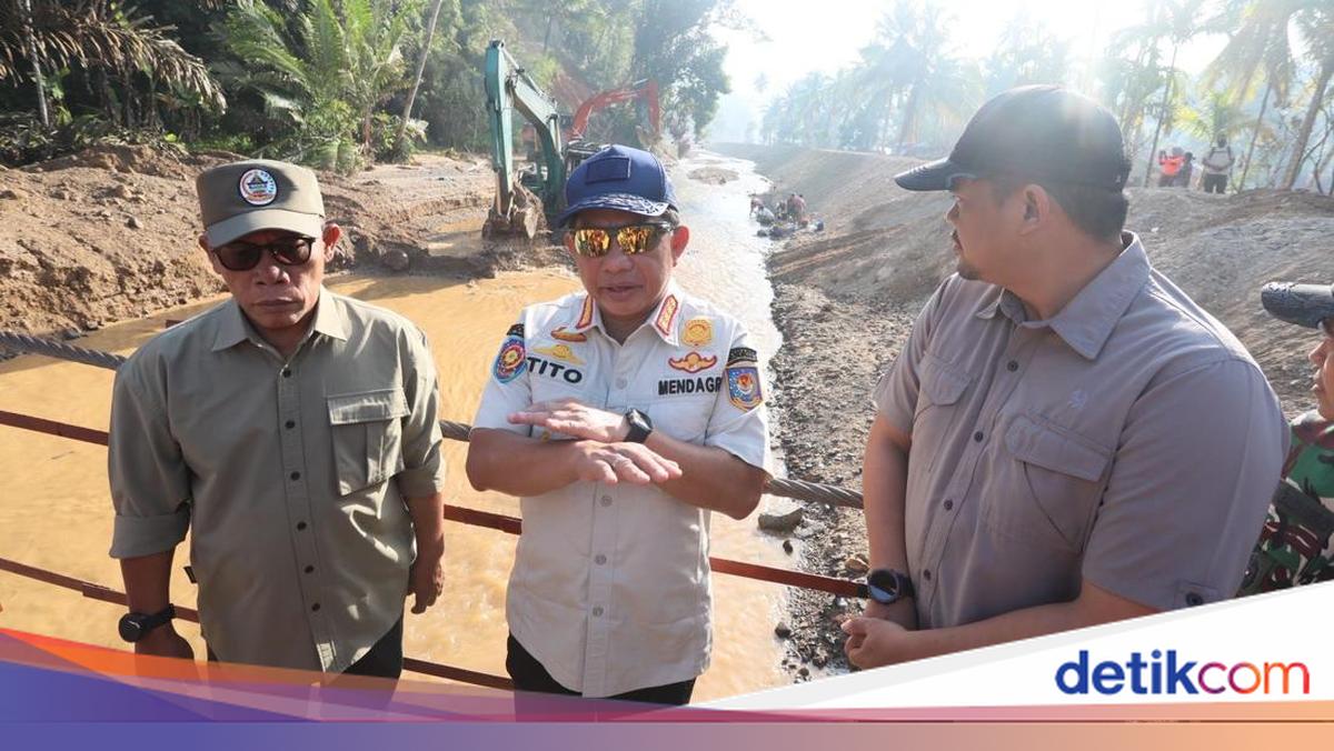
Satgas PRR Chair, Muhammad Tito Karnavian, stated that river normalisation is crucial to support the livelihoods of communities reliant on primary economic sectors such as agriculture and fisheries. Based on Satgas PRR data, the rivers affected by hydrometeorological disasters in Aceh, West Sumatra, and North Sumatra are mostly experiencing shallowing due to sedimentation.
“Rivers are important to me; this will take a long time for the rivers because there are many of them. In total, many are sedimented, long and wide. This handling is urgent because it directly relates to the rice fields and fish ponds owned by the public,” said Tito in a written statement on Wednesday (25/3/2026).
Satgas PRR data indicates that in the affected areas, there are dozens of rivers with varying conditions, ranging from heavy sedimentation, embankment damage, to changes in river courses. In Aceh Province, 55 affected rivers have been recorded that require phased handling. The distribution of river damage in Aceh covers the regions of North Aceh, Pidie, Pidie Jaya, Bireuen, Central Aceh, Bener Meriah, Langsa, East Aceh, Aceh Tamiang, South Aceh, West Aceh, Nagan Raya, Southeast Aceh, and Subulussalam.
Meanwhile, in North Sumatra Province, there are 48 affected rivers covering the areas of Central Tapanuli, South Tapanuli, North Tapanuli, Humbang Hasundutan, Sibolga, Medan, Deli Serdang, Langkat, Serdang Bedagai, Mandailing Natal, and Batu Bara. In West Sumatra, 43 affected rivers have been recorded, covering Padang, Padang Pariaman, Pasaman, West Pasaman, Solok, Tanah Datar, Agam, and South Pesisir.
Tito also explained that river handling is carried out through two main approaches: emergency response to anticipate further impacts, and rehabilitation and reconstruction to ensure permanent repairs. According to him, the geographical conditions of the affected areas, which are scattered, pose their own challenges in river recovery.
“If we enter areas near the rivers, they are affected. So this is scattered, sporadic in nature. That’s what makes the handling require time,” he said.
Nevertheless, Satgas PRR ensures that river handling efforts continue in parallel with the recovery of other sectors. To date, most national roads have returned to 100 percent functionality, and logistics distribution is no longer hindered, thereby supporting the acceleration of river repairs in various areas.
In addition, the government also ensures that river handling is integrated with the recovery of other sectors such as agriculture, fish ponds, and community housing along the river basins. Tito emphasised that post-disaster recovery is not only measured by the reduction in the number of evacuees but also by the region’s ability to return to being safe and productive.
“The variables we look at are not just evacuees, but also rivers, rice fields, fish ponds, and other infrastructure. All of that is part of the recovery,” he concluded.