Perhapi probes the impact of mining operations in the Garoga Watershed
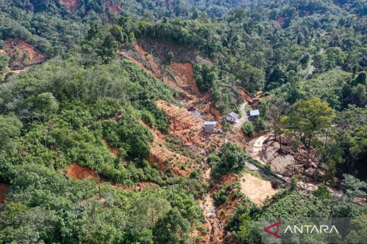
Jakarta – The Indonesian Mining Professionals Association (Perhapi) organised a focus group discussion (FGD) to deepen understanding of the impact of mining operations in the Garoga watershed, South Tapanuli, North Sumatra, and its correlation with floods at the end of 2025.
‘Perhapi notes the existence of the latest independent research conducted by the Center for Analysis and Applying Geospatial Information (CENAGO) of the Bandung Institute of Technology (ITB),’ said Perhapi Chairman Sudirman Widhy Hartono in a statement received in Jakarta on Wednesday.
Sudirman said the study was conducted comprehensively through field investigations lasting about two months, namely December 2025–January 2026. The results of the study have been presented to stakeholders, including the government, on 18 February.
Sudirman added that there are mining companies operating in the Garoga watershed that are also under scrutiny in the issue, namely PT Agincourt Resources (PT AR).
Based on CENAGO’s findings, he continued, there is discussion on floods in the Garoga watershed, which hydrographically are separate from the sub-DAS operated by PT AR.
Meanwhile, the Chairman of the Indonesian Association of Geologists (IAGI) STJ Budi Santoso assessed that data-based field studies are an important reference for policymaking.
‘I believe the government will or should use data and findings grounded in real data, collected in the field by those with competence and who can be held to account before their peers — that is, among the experts with the same expertise, to defend the study results,’ he said.
Previously, the ITB research team stated that the flash floods that hit several areas in Aceh, North Sumatra, and West Sumatra in November 2025 were triggered by extreme weather that exceeded national flood mitigation standards.
ITB’s Center for Analysis and Applying Geospatial Information (CENAGO) research coordinator Heri Andreas said the conditions were the result of an extreme precipitation analysis-based forensic study, the hydrological characteristics of the three river basins (Badiri, Garoga, and Batang Toru) in North Sumatra, land-use changes, and hydrological-hydraulics simulations.
From the study, very extreme rainfall was found to exceed the capacity of existing flood-control systems, which were not designed to withstand such an event.’} ) } ąż} // Note: remove extraneous characters? Wait: The input inserted stray characters at end; ensure valid JSON. We need to ensure body string properly escaped. The