Mount Semeru erupts seven times with plume heights reaching 1 kilometre
Mount Semeru, situated on the border of Lumajang and Malang regencies in East Java, was recorded erupting seven times on Friday morning, with plume heights ranging from 500 metres to 1 kilometre above the summit.
“The first eruption occurred at 00.14 Western Indonesian Time, with the eruption column observed at approximately 700 metres above the summit. The ash column appeared white to grey with moderate intensity drifting northward. At the time the report was compiled, the eruption was still ongoing,” said Liswanto, an officer at the Mount Semeru Observation Post, in a written report received in Lumajang.
The second eruption followed at 00.24 Western Indonesian Time, with an eruption column observed at approximately 700 metres above the summit and a white-to-grey ash column of moderate intensity moving northward.
The third and fourth eruptions occurred consecutively at 05.18 and 05.23 Western Indonesian Time, though the eruption visuals were not observable. At the time of reporting, the eruptions were still ongoing.
Java’s tallest volcano erupted again at 05.56 Western Indonesian Time, with the eruption column observed at approximately 500 metres above the summit. The ash column appeared white to grey with moderate intensity drifting northward. The eruption was still ongoing when the report was filed.
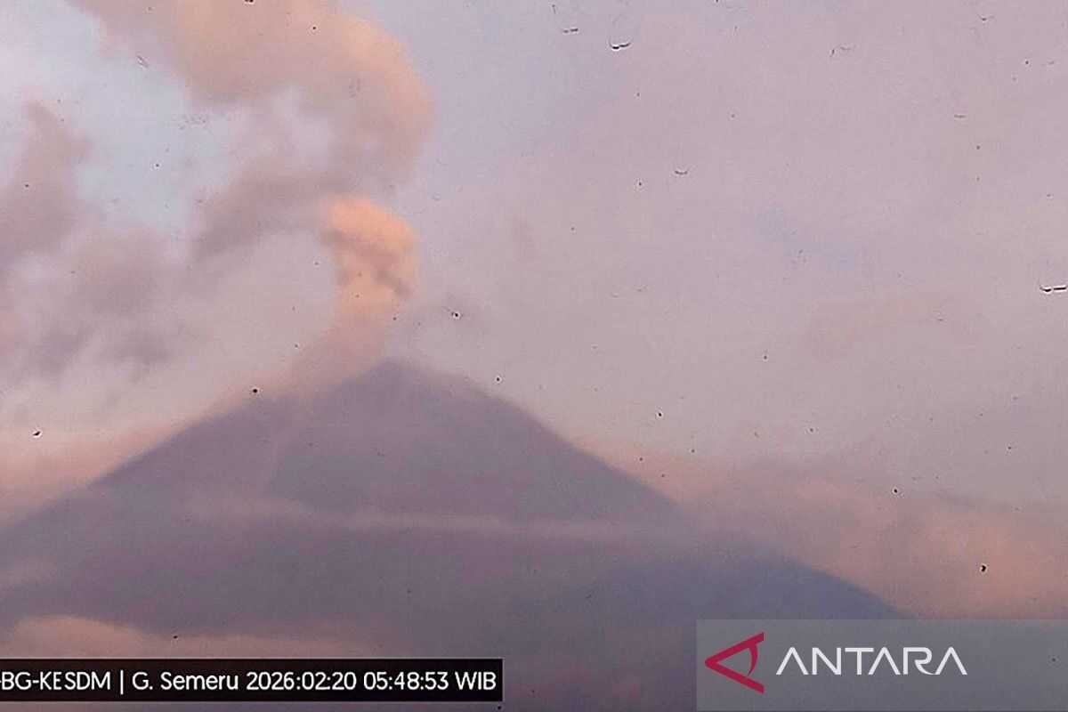
“Then at 05.48 Western Indonesian Time, Mount Semeru erupted again with a plume height reaching 1 kilometre above the summit, with the ash column observed as white to grey with moderate intensity moving eastward,” Liswanto said.
Mount Semeru erupted once more at 07.15 Western Indonesian Time, with the eruption column observed at approximately 900 metres above the summit. The ash column appeared white to grey with thick intensity drifting north and north-east. The eruption was recorded on the seismograph with a maximum amplitude of 22 millimetres and a duration of 125 seconds.
Liswanto explained that Mount Semeru remains at volcanic activity Level III (Alert), prompting the Centre for Volcanology and Geological Hazard Mitigation (PVMBG) to issue a number of recommendations. Residents are prohibited from conducting any activities in the south-eastern sector along Besuk Kobokan, up to 13 kilometres from the summit.
Beyond that distance, residents must not conduct activities within 500 metres of the riverbanks along Besuk Kobokan, owing to the potential for pyroclastic flow expansion and lahars reaching up to 17 kilometres from the summit.
“Residents are also prohibited from any activities within a 5-kilometre radius of the crater or summit of Mount Semeru, due to the danger of incandescent rock projectiles,” he said.
The public should remain vigilant against the potential for pyroclastic flows, lava avalanches and lahars along river channels and valleys originating from the summit of Mount Semeru, particularly along Besuk Kobokan, Besuk Bang, Besuk Kembar and Besuk Sat, as well as the potential for lahars in smaller rivers that are tributaries of Besuk Kobokan.