Mount Semeru Erupts Again, Ash Column Reaches 3 km Above Peak
Mount Semeru Erupts Again, Ash Column Reaches 3km Above Peak
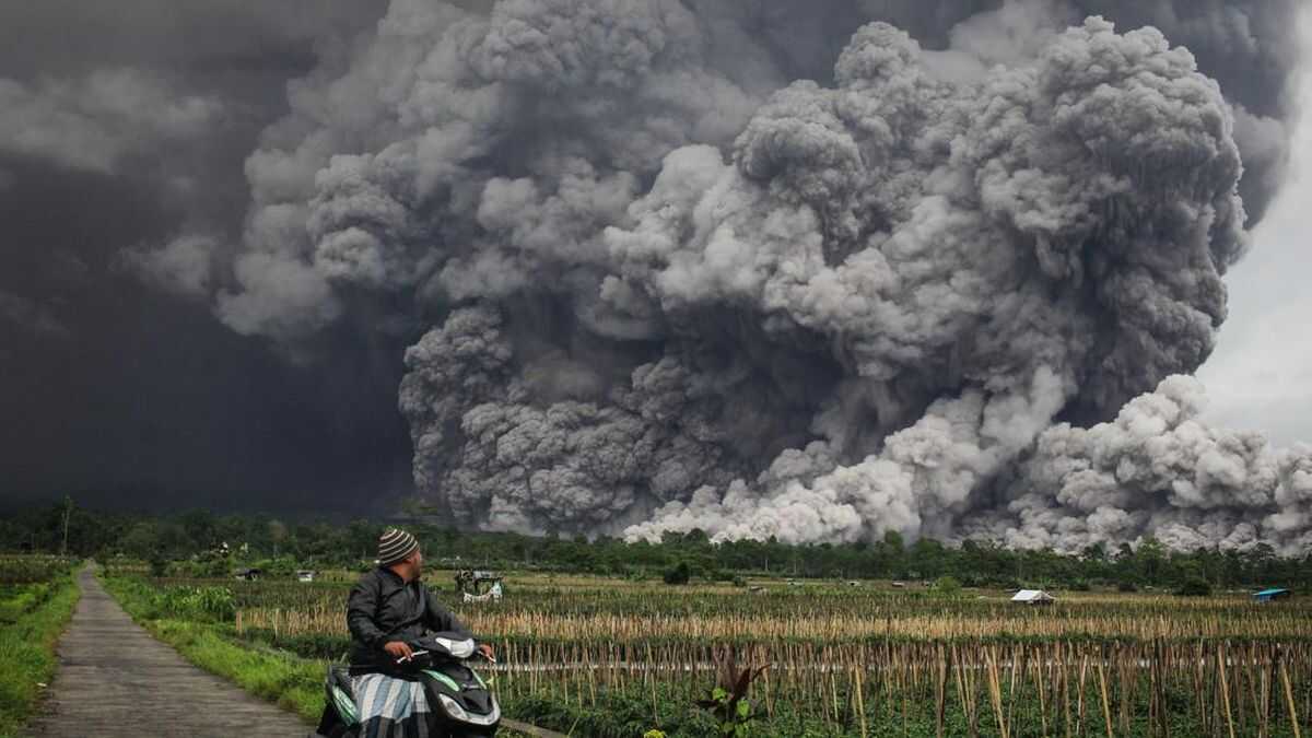
Mount Semeru, located on the border of Lumajang and Malang regencies in East Java, erupted again on Tuesday (24 February) afternoon, with the eruption reaching a height of 3,000 metres above the peak.
“An eruption of Mount Semeru occurred at 17:36 local time, with the height of the ash column observed to be approximately 3,000 metres above the peak, or 6,676 metres above sea level,” said Liswanto, an officer at the Mount Semeru Observation Post, in a written report received in Lumajang.
According to him, the ash column was observed to be grey to brown in colour, with a thick intensity moving towards the southeast. At the time the report was written, the eruption was still ongoing. The eruption was recorded on the seismogram with a maximum amplitude of 22 mm and a temporary duration of approximately 2 minutes and 25 seconds.
This eruption is the second in a single day. On Tuesday morning, Mount Semeru also erupted again at around 01:51 local time, accompanied by a pyroclastic flow that travelled approximately 3,000 metres from the crater, heading southeast towards Besuk Kobokan.
Liswanto said that Mount Semeru is at volcanic activity level III (Alert), so the Centre for Volcanology and Geological Hazard Mitigation (PVMBG) has issued several recommendations, namely that the public should not carry out any activities in the southeastern sector along Besuk Kobokan, within a radius of 13 kilometres from the peak (eruption centre).
Outside this distance, he said, the public should not carry out activities within 500 metres of the riverbank (river boundary) along Besuk Kobokan, as there is a potential for the expansion of the pyroclastic flow and lahar flows up to a distance of 17 kilometres from the peak.
“The public is also prohibited from carrying out activities within a radius of 5 kilometres from the crater/peak of Mount Semeru, as there is a risk of rock (pyroclastic) projectiles,” he said.
The public needs to be aware of the potential for pyroclastic flows, lava flows, and lahar along the river/valley streams that originate at the peak of Mount Semeru, especially along Besuk Kobokan, Besuk Bang, Besuk Kembar, and Besuk Sat, as well as the potential for lahar in the small rivers that are tributaries of Besuk Kobokan.
(antara/rds)