Mount Merapi launches pyroclastic flows up to 1.6 km on Monday morning
Mount Merapi, located on the border of Daerah Istimewa Yogyakarta (Special Region of Yogyakarta) and Central Java, launched two pyroclastic flows with a maximum distance of 1.6 kilometres towards the southwest on Monday early morning.
Agus Budi Santoso, Head of the Geological Disaster Research and Development Centre (BPPTKG) in Yogyakarta, reported that the pyroclastic flows were directed to the southwest or Kali Krasak based on observations between 00.00 and 06.00 WIB.
“Two pyroclastic flows towards the southwest (Kali Krasak) were observed with a maximum launch distance of 1,600 metres,” stated Agus in his statement in Yogyakarta on Monday.
The pyroclastic flows recorded had an amplitude of 18–33 millimetres with a duration of 175.24–188.35 seconds.
During the same observation period, Mount Merapi also experienced 49 rockfall earthquakes with amplitudes of 2–41 millimetres and duration of 57.8–182.25 seconds, as well as 14 hybrid earthquakes or multi-phase earthquakes with amplitudes of 2–30 millimetres and duration of 26.98–49.61 seconds.
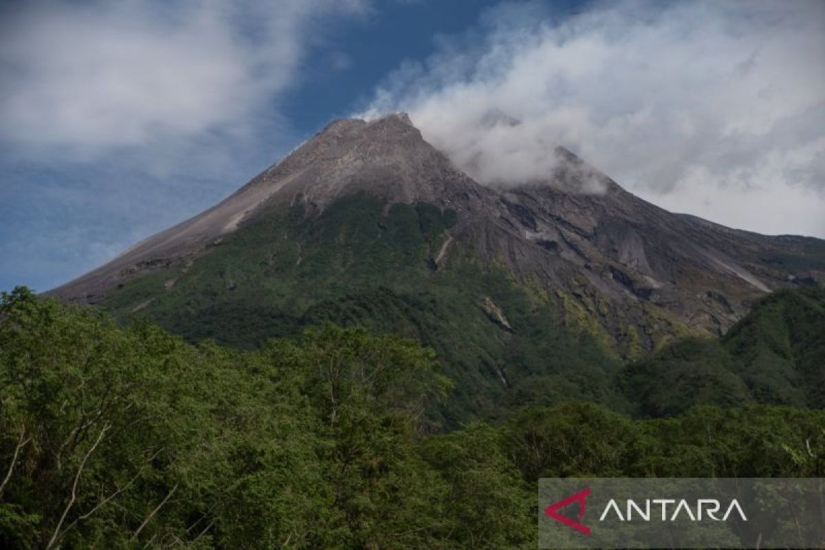
Visually, he noted, the mountain was clearly visible with weak-pressure crater smoke in white colour with moderate to high intensity approximately 500 metres above the crater peak.
Weather conditions around the mountain were cloudy to clear with air temperatures ranging from 17.2–19.2 degrees Celsius.
BPPTKG’s report for the period of 6–12 March 2026 also noted that the morphology of the southwest dome of Mount Merapi has undergone changes due to lava rockfall activity and changes in dome volume.
“For the central dome, no significant morphological changes were observed,” said Agus.
BPPTKG continued to maintain Mount Merapi’s status at Level III or Alert.
Current hazard potential includes lava flows and pyroclastic flows in the south-southwest sector covering the Boyong River extending a maximum of five kilometres as well as the Bedog, Krasak, and Bebeng rivers, extending a maximum of seven kilometres.
In the southeast sector, hazards cover the Woro River extending a maximum of three kilometres and the Gendol River extending a maximum of five kilometres.
Should an explosive eruption occur, volcanic material ejected from Mount Merapi could reach areas within a radius of three kilometres from the summit.