Ministry Charts Blue Carbon Reserves Across Industrial Coastal Zones
REPUBLIKA.CO.ID, JAKARTA – The Ministry of Marine Affairs and Fisheries is exploring opportunities for synergy with industry players to map locations for blue carbon initiatives in coastal areas. Clear marine spatial planning is considered a key foundation to support investment and the development of national blue carbon projects.
The Director General of Marine Spatial Planning at the Ministry, Kartika, stated that clear marine spatial planning is achieved through the integration of Marine Spatial Plans, the designation of blue carbon reserve locations, and the acceleration of licensing for activities related to the utilisation of marine space.
“In the management of blue carbon, clear, well-directed, and measurable marine spatial planning will provide tangible benefits for industry, coastal communities, and the resilience of our coasts,” said Kartika on Tuesday (24 February 2026).
Kartika added that blue carbon is becoming an instrument for development that links ecosystem protection with economic value. Therefore, the Ministry is exploring cooperation with the Ministry of Industry, the Association of Industrial Estates, Kadin (the Indonesian Employers’ Association), and industrial estate managers to map the allocation of blue carbon space and its financing schemes.
Kartika said that blue carbon projects have a long-term character and must be ecologically viable and attractive to investors. “Blue carbon projects are long-term (30–40 years), so they must not only be ecologically viable but also creditworthy and attractive to investors,” Kartika said.
The Director of Marine Spatial Planning Development, Amehr Hakim, stated that the management of blue carbon projects is carried out through standardised stages, starting from feasibility assessments to monitoring based on the Marine Spatial Planning Information System and the Ocean Monitoring System.
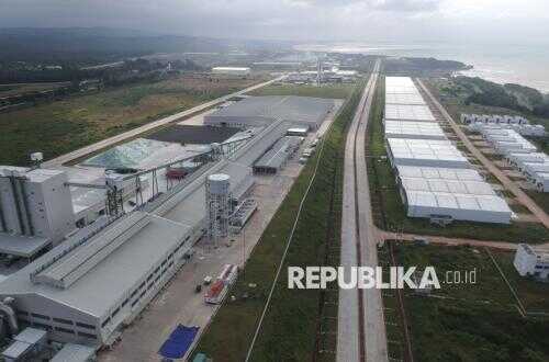
“As a model for integrating blue carbon into the management of coastal industrial areas, the Batang and Semarang regions in Central Java have been designated as priority areas because they face pressure from abrasion, tidal flooding, and coastal degradation, while also holding great potential for the development of blue carbon projects,” said Amehr.
Amehr said that the Ministry plays a role as a regulator, while local governments ensure the alignment of spatial planning and licensing. Industrial areas will provide locations for rehabilitation and become buyers of carbon credits, while coastal communities will be involved as conservation partners.
The Ministry is also accelerating the preparation of technical regulations, feasibility studies in Central Java, and the designation of priority locations for pilot projects. The Minister of Marine Affairs and Fisheries, Sakti Wahyu Trenggono, previously affirmed the government’s commitment to protecting blue carbon ecosystems to support environmental sustainability and the welfare of coastal communities.