Magnitude 5.0 Earthquake Shakes Sumba, East Nusa Tenggara; BMKG: No Tsunami Risk
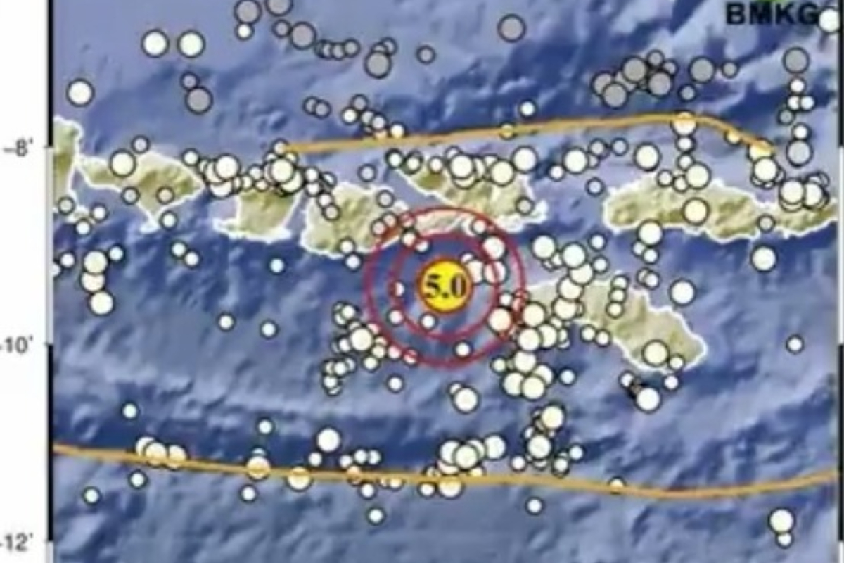
A magnitude 5.0 earthquake struck Kodi in South West Sumba, East Nusa Tenggara (NTT), on Monday 16 March at 18:41 Western Indonesia Time.
According to the Meteorological, Climatological and Geophysical Agency (BMKG), the Sumba earthquake poses no tsunami risk.
The earthquake was centred at 9.41 degrees South latitude and 118.18 degrees East longitude, approximately 91 kilometres northwest of Kodi in South West Sumba, at a depth of 37 kilometres.
“This information prioritises speed, so data processing results are not yet stable and may change as data becomes complete,” BMKG stated.
Recent seismic activity has also affected other regions. Two residential buildings in Sukabumi district, West Java, were reported damaged following a 4.2 magnitude earthquake on Sunday 15 March, with the structures located at two separate sites.
BMKG reported a tectonic earthquake in the South Sea off Sukabumi, West Java, on 13 March at 02:18 Western Indonesia Time, which posed no tsunami risk.
A 5.4 magnitude earthquake centred in Sukabumi city at a depth of 43 kilometres also posed no tsunami threat.
BMKG documented at least 20 earthquakes ranging from magnitude 2.1 to 4.1 across various regions of Indonesia during the early hours of Tuesday 10 March.
The Sukabumi earthquake was positioned at 7.62 degrees South latitude and 106.41 degrees East longitude, 71 kilometres southwest of Sukabumi district, or approximately 26 kilometres offshore.
Based on the epicentre location and hypocentric depth, the earthquake was classified as a shallow quake triggered by active fault activity in the region.