Land-Use Change Blamed for Flooding Crisis; Local Authorities Urged to Tighten Permits
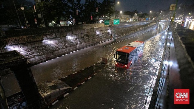
Land-use conversion in downstream areas is considered a significant factor exacerbating flood risk in urban areas. The development of residential and warehouse zones in low-lying regions has reduced the area’s capacity to absorb rainwater.
David Partonggo Oloan Marpaung, Head of the Ciliwung-Cisadane River Basin Authority, stated that spatial planning control is a critical element in managing river catchment areas.
According to him, many development projects are being constructed in areas that naturally function as water retention basins. “Housing clusters are frequently built in lowland areas, in swampy depression zones that are simply filled in,” David told CNBC Indonesia on Monday (9 March 2026).
This situation causes rainwater that should be naturally retained to flow more rapidly into rivers instead. Consequently, the water flow burden on rivers increases and magnifies flood risk in downstream areas.
He believes local governments have an important role to play in controlling development in flood-prone regions. “How effectively local governments can regulate land-use conversion on land is crucial,” he said.
Additionally, the building permit process needs to be strengthened to prevent further environmental deterioration. “Permits issued must be more stringent, particularly for development in downstream and upstream areas,” David stated.
According to him, river management cannot be handled by the central government alone since many factors affecting rivers originate from surrounding land. “We are responsible for managing the river itself, but much of what enters the river comes from the surrounding land,” he explained.
Therefore, cross-government coordination among local authorities has become an essential component of urban flood mitigation. “We continue to collaborate to ensure disaster mitigation is implemented more effectively,” David said.