KKP Involves Communities in Coastal Spatial Planning
JAKARTA — The Ministry of Marine Affairs and Fisheries (KKP) is encouraging data-based marine spatial governance with community participation. This approach is deemed crucial to ensure that marine policies are more accurate and not detached from field conditions.
KKP is beginning to integrate marine resource balance sheets or ocean accounting with participatory mapping. This model is used to measure the economic, social, and ecological value of the sea more comprehensively.
Director General of Marine Spatial Planning Kartika Listriana stated that the main challenge is not only about regulations, but how field data can enter the national planning system.
“Another challenge is how to ensure that the results of this mapping do not stop as community data, but can be integrated into the formal planning system, recognised in policy, and utilised in national decision-making,” she said on Thursday (23/4/2026).
Kartika emphasised that marine spatial planning is now a strategic instrument to balance economic, social, and ecological interests. This scheme is also used to reduce conflicts in space utilisation and strengthen coastal ecosystem resilience.
This approach was discussed at the National Workshop on the Integration of Participatory Mapping and Ocean Accounting in Jakarta. The forum highlighted the importance of synchronising methodologies and standards in national marine spatial planning.
IPB University marine economics expert Prof. Akhmad Fauzi stated that integrating data and community participation will strengthen the quality of planning. Data is considered important, but not sufficient without validation from the community.
“Through participatory mapping, communities can contribute by providing contextual local information, validating data, and enriching perspectives in marine spatial planning,” he explained.
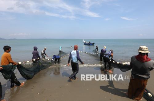
Representative of Blue Ventures Indonesia, Miftahul Khausar, assessed that cross-party collaboration needs to be strengthened, especially in supporting small and traditional fishers. Synchronising data on coastal community activities is deemed important to prevent marine spatial conflicts.
“There is much potential for collaboration that can be developed at both local and national levels to jointly strengthen the marine and fisheries sector, including synchronising data on coastal community activity areas to create more inclusive, participatory marine governance and minimise frequent conflicts,” he said.
KKP stated that this approach aligns with the blue economy policy that encourages ecosystem balance and improved welfare for coastal communities.