Jakarta on Alert: Landslide Hazard Threatens Multiple Districts, Key Locations Identified
Jakarta, Indonesia — The Jakarta Disaster Management Agency (BPBD) has released an early warning map identifying potential landslide hazards across several areas of the capital for March 2026. The map was compiled through an overlay analysis combining soil movement vulnerability zones with monthly rainfall forecasts from the National Meteorological, Climatological, and Geophysical Agency (BMKG).
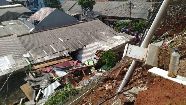
Based on information from the Centre for Volcanology and Geological Hazard Mitigation (PVMBG), several districts across Jakarta province are classified as Medium-Risk Zone areas for landslide incidents.
The affected areas include:
South Jakarta Administrative District: Cilandak, Jagakarsa, Kebayoran Baru, Kebayoran Lama, Mampang Prapatan, Pasar Minggu, and Pesanggrahan subdistricts.
East Jakarta Administrative District: Kramatjati and Pasar Rebo subdistricts.
Medium-Risk Zones are defined as areas with moderate potential for ground movement. Landslides in these zones may occur during above-normal rainfall, particularly in areas adjacent to river valleys, steep slopes, road embankments, or where slopes experience disturbance. High-Risk Zones, by contrast, have elevated potential for landslide activity and may reactivate dormant landslides during above-normal rainfall conditions.
BPBD has issued several recommendations for residents both before and after settling in landslide-prone areas.
Before establishing residence:
Avoid constructing permanent buildings in hazard-prone areas such as cliff faces, steep slopes, riverbanks, and unstable ground
Prepare retention structures and landslide barriers
Install robust drainage systems for rainwater runoff
Compact soil and reinforce building foundations
Avoid indiscriminate tree-felling
For those already residing in at-risk areas:
Undertake reforestation efforts using deep-rooted vegetation
Monitor rainfall levels and stay informed through official early warning systems regarding ground movement alerts
Prepare emergency disaster kits for emergencies
Do not delay evacuation and be prepared to relocate immediately to safe areas during extreme weather conditions
The Head of the Geology Agency under the Ministry of Energy and Mineral Resources, Lana Saria, previously explained that landslide disasters do not occur in isolation but are closely linked to Indonesia’s monsoon dynamics. Indonesia’s tropical climate features high rainfall volumes and prolonged wet seasons, particularly during peak monsoon periods, causing soil saturation. Rainwater infiltrates deeply into weathered soil layers, filling soil pores and increasing pore water pressure. As pore water pressure rises, soil shear strength declines, rendering previously stable slopes unstable and prone to movement.
Saria cited examples including the Padasari village incident in Tegal Regency, where steep slopes of 25-43° consist of sandstone overlying impermeable clay shale and marl. During extended rainfall, water becomes trapped above the impermeable layer, creating a natural slip plane. This resulted in slow-moving creep-type landslides that accelerated rapidly following intense rainfall.
Similarly, in Pabuaran village, Sukamakmur, Bogor Regency, thick clay weathering layers overlie cohesion-deficient marl and shale. Despite relatively gentle slopes, continuous water infiltration during the monsoon season accelerated soil creep, causing significant cracking and subsidence.
Regarding the relationship between landslides and seismic activity, Saria noted that whilst rainfall is typically the primary triggering factor in documented cases, Indonesia does occupy a seismically active tectonic zone. Earthquakes can serve as additional triggers on already-saturated, critically-positioned slopes, with seismic vibrations suddenly reducing slope stability. However, without rainfall saturation, landslide potential during earthquakes is typically lower than during peak monsoon periods.
In response, the Geology Agency’s Centre for Volcanology and Geological Hazard Mitigation regularly publishes monthly Soil Movement Vulnerability Maps and Landslide Forecast Maps based on rainfall data. Post-incident technical recommendations are provided through formal reports. Areas such as Tegal and Bogor already fall within Medium to High Vulnerability Zones, indicating that spatial planning regulations should provide special management provisions for these regions.