Jakarta Flooding Update on Friday Evening: 127 Neighbourhood Units and 6 Roads Still Inundated
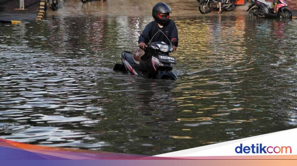
Flooding struck multiple areas of Jakarta following heavy rainfall. As of Friday evening, the Jakarta Regional Disaster Mitigation Agency (BPBD) recorded 127 neighbourhood units (RT) and six road segments still inundated.
“The BPBD currently records 127 RT and 6 road segments flooded,” said Muhammad Yohan, Head of the Data and Information Centre at BPBD DKI Jakarta, in a statement on Friday (20 February 2026). The data was updated as of 6.00pm Western Indonesian Time (WIB).
South Jakarta was recorded as the area with the highest number of flooded neighbourhood units. Water levels varied from 30 to 125 centimetres.
BPBD DKI Jakarta has deployed personnel to monitor flooding conditions in each area and is coordinating with the Water Resources Agency, the Highways Agency, and the Fire and Rescue Service to pump out floodwater and ensure drainage channels are functioning properly, in cooperation with local village and sub-district heads, whilst also preparing basic necessities for affected residents. Floodwaters are targeted to recede as quickly as possible.
BPBD DKI urged the public to remain cautious and vigilant against potential flooding. In an emergency, residents should immediately contact the telephone number 112. The service is free of charge and operates 24 hours without interruption.
The data on affected areas is as follows:
West Jakarta — 33 RT affected:
- Kedaung Kali Angke: 11 RT — Water level: 30 to 80 cm — Cause: Heavy rainfall and Kali Angke overflow
- Rawa Buaya: 11 RT — Water level: 30 to 70 cm — Cause: Heavy rainfall and Kali Angke overflow
- Kebon Jeruk: 1 RT — Water level: 40 cm — Cause: Heavy rainfall
- Kedoya Selatan: 5 RT — Water level: 80 cm — Cause: Heavy rainfall
- Kembangan Selatan: 3 RT — Water level: 40 cm — Cause: Heavy rainfall and Kali Pesanggrahan overflow
- Kembangan Utara: 2 RT — Water level: 40 cm — Cause: Heavy rainfall
South Jakarta — 48 RT affected:
- Cipulir: 1 RT — Water level: 70 cm — Cause: Heavy rainfall and Kali Pesanggrahan overflow
- Cilandak Barat: 1 RT — Water level: 30 cm — Cause: Heavy rainfall and Kali Krukut overflow
- Pondok Labu: 1 RT — Water level: 30 cm — Cause: Heavy rainfall and Kali Krukut overflow
- Tanjung Barat: 1 RT — Water level: 40 cm — Cause: Heavy rainfall and Ciliwung River overflow
- Pondok Pinang: 6 RT — Water level: 90 cm — Cause: Heavy rainfall and Kali Pesanggrahan overflow
- Pela Mampang: 2 RT — Water level: 30 cm — Cause: Heavy rainfall and Kali Mampang overflow
- Rawajati: 3 RT — Water level: 30 cm — Cause: Heavy rainfall and Ciliwung River overflow
- Cilandak Timur: 2 RT — Water level: 40 to 85 cm — Cause: Heavy rainfall and Kali Krukut overflow
- Pejaten Timur: 3 RT — Water level: 95 cm — Cause: Heavy rainfall and Ciliwung River overflow
- Bintaro: 8 RT — Water level: 40 to 70 cm — Cause: Heavy rainfall and Kali Pesanggrahan overflow
- Pesanggrahan: 9 RT — Water level: 30 to 60 cm — Cause: Heavy rainfall and Kali Uangan overflow
- Petukangan Utara: 10 RT — Water level: 100 cm — Cause: Heavy rainfall and Kali Uangan overflow
- Ulujami: 1 RT — Water level: 90 cm — Cause: Heavy rainfall and Kali Uangan overflow
East Jakarta — 45 RT affected:
- Kampung Melayu: 16 RT — Water level: 110 to 150 cm — Cause: Heavy rainfall and Ciliwung River overflow
- Bidara Cina: 19 RT — Water level: 80 to 125 cm — Cause: Heavy rainfall and Ciliwung River overflow
- Balekambang: 1 RT — Water level: 80 cm — Cause: Heavy rainfall and Ciliwung River overflow
- Cawang: 7 RT — Water level: 40 to 80 cm — Cause: Heavy rainfall and Ciliwung River overflow
- Cililitan: 2 RT — Water level: 80 cm — Cause: Heavy rainfall and Ciliwung River overflow
North Jakarta — 1 RT affected:
- Rorotan: 1 RT — Water level: 50 cm — Cause: Heavy rainfall and Kali Cakung Drain overflow
Areas where floodwater has receded:
- Lebak Bulus: 2 RT
- Pesanggrahan: 2 RT
- Cilandak Timur: 1 RT
- Kebayoran Lama Utara: 1 RT
- Cipete Utara: 3 RT
- Petogogan: 39 RT
Six flooded road segments:
- Jl. Pondok Karya, Pela Mampang, South Jakarta — Water level: 60 cm
- Jl. Strategi Raya, Joglo, West Jakarta — Water level: 30 cm
- Jl. Basoka Raya, Joglo, West Jakarta — Water level: 40 cm
- Jl. Puri Kembangan (in front of SMK Budi Murni school), Kedoya Selatan, West Jakarta — Water level: 60 cm
- Jl. Daan Mogot (Pabrik Gelas), Rawa Buaya, West Jakarta — Water level: 20 cm
- Jl. Kali Sekretaris Pospol RW.05, Duri Kepa, West Jakarta — Water level: 30 cm
Road segments where floodwater has receded:
- Jl. Ciledug Raya (in front of Shell petrol station), Petukangan Selatan, South Jakarta
- Jl. Gaya Motor Raya, Kebon Bawang, North Jakarta
- Jl. Srengseng Raya, Srengseng, West Jakarta
- Jl. Daan Mogot, KM 13, Rawa Buaya, West Jakarta