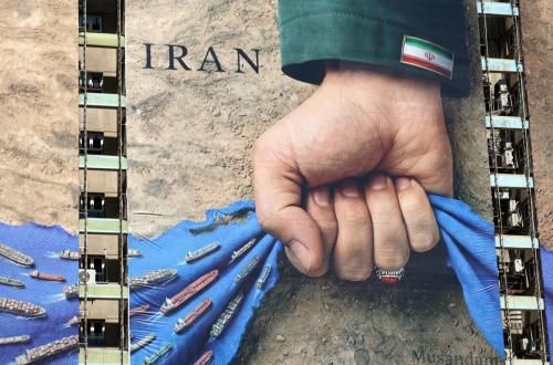
IRGC Releases New Map of Strait of Hormuz, Asserting Iran's Full Control
Tehran – Iran’s Islamic Revolutionary Guard Corps (IRGC) released a new map of the Strait of Hormuz under their full control on Monday (4/5/2026). The release of this map came just hours after the US President announced an initiative to escort ships passing through the Strait of Hormuz named Project Freedom.
Local media reported, citing the Telegraph, that in the new map, the Strait of Hormuz begins on the west with a line stretching from the westernmost tip of Qeshm Island in Iran to Umm al Quwain in the United Arab Emirates. On the east, the area stops at a line stretching from Mount Mobarak in Iran to the Emirate of Fujairah in the United Arab Emirates.
The reason why the IRGC changed the control area in the Strait of Hormuz through the new map remains unclear. Meanwhile, Donald Trump previously stated that the US would begin freeing ships that have been stranded in the Persian Gulf region due to the closure of the Strait of Hormuz by Iran since the war broke out at the end of February 2026.
The US Central Command (CENTCOM) on Sunday (3/5/2026) stated that its forces would “support commercial ships wishing to pass freely” through the Strait of Hormuz under the framework of US President Donald Trump’s initiative called “Project Freedom.” In a post on the social media platform X, CENTCOM mentioned that its forces would begin supporting Project Freedom on 4 May 2026 to restore freedom of navigation for commercial shipping in the Strait of Hormuz.
CENTCOM added that support for commercial ships crossing the strait would include guided-missile destroyers, more than 100 land- and sea-based aircraft, multi-domain unmanned platforms, and 15,000 military personnel.
“Our support for this defence mission is vital for regional security and the global economy, while we continue to maintain the naval blockade,” said CENTCOM Commander Admiral Brad Cooper.