How China Became Iran's "Spy" Through the Sky Route
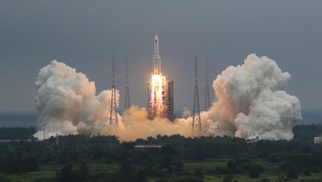
Jakarta, CNBC Indonesia - Amid the war between the United States (US) and Iran, China is beginning to play an important role through its satellite imagery. Although its support for Iran since the outbreak of Operation “Epic Fury” on 28 February has appeared very cautious, Beijing’s contributions from outer space are starting to attract attention.
Openly, Beijing has indeed not provided significant, conspicuous assistance, either economically, diplomatically, or militarily. However, behind that, there is another, more indirect contribution that could be even more important, namely from outer space.
On 2 March 2026, a spokesperson for China’s Ministry of Foreign Affairs stated that the attacks by the United States and Israel violated international law. At the same time, Chinese ships carrying sodium perchlorate, a material potentially used in missile propellant, are believed to have arrived in Iran earlier this month.
US intelligence has also reportedly warned that China is preparing to ship shoulder-fired rockets, a type of weapon that can be used to shoot down low-flying US helicopters or aircraft.
Nevertheless, the most tangible form of support from China comes through satellite imagery.
Chinese Satellite Images Flood Social Media as Western Access Tightens
Social media has recently been filled with images of the Middle East taken by Chinese satellites and released by companies from the Bamboo Curtain country. This phenomenon has emerged just as US-based satellite companies are tightening access under pressure from the Donald Trump administration, leaving journalists, researchers, and activists without one of their key sources of open-source intelligence.
The proliferation of images from China demonstrates that the country’s capabilities in satellite observation are developing very rapidly, both in terms of coverage and sophistication.
This situation also marks the end of Western dominance over the most advanced satellite imagery from outer space. However, for analysts relying on open sources, the presence of Chinese imagery is not just a lifeline but also a warning.
The Iran war has become a massive free advertising opportunity for Chinese satellite companies.
Bill Greer, a geospatial analyst and one of the founders of Commonspace, a non-profit satellite service, believes that the restrictions from the Trump government are actually benefiting US competitors, when it didn’t need to happen.
According to him, the US is essentially harming its own commercial satellite industry in order to limit access, even though adversaries can still obtain data through other systems.
In recent weeks, evidence of cooperation between Chinese satellite companies and Iran has also increased. China Siwei, which is part of the state-owned China Aerospace Science and Technology Corporation, is known to have taken high-resolution photos of US and allied military locations.
The Financial Times also reported that Iran’s Revolutionary Guard has purchased a Chinese satellite. That satellite is suspected to be the source of some of the images aired by Iranian state media, including photos showing the results of their attacks that caused severe damage.
China’s Satellite Fleet Grows Larger and Sharper
The abundance of images from China is inseparable from the rapid growth of that country’s satellite constellation.
Throughout 2025 alone, China launched more than 120 satellites monitoring Earth’s surface, including satellites using radar, radio waves, and cameras. With that addition, the total number of China’s Earth-observation satellites in orbit now exceeds 640 units, a figure second only to the US.
In the US, almost all commercial satellite companies depend on selling images to the military and intelligence agencies. But in China, the line between private companies and the state is considered much blurrier.
The largest constellation in the country is Jilin-1, which has more than 100 satellites and is operated by Chang Guang Satellite Technology (CGST), a company said to have close ties to the People’s Liberation Army (PLA).
This company’s targets are very ambitious, namely to be able to image any point on Earth every 10 minutes.
In the race to lead in Earth observation, Chinese and US commercial satellites are now considered to be running almost neck and neck. Siwei’s Superview Neo-1 satellite is said to be capable of producing images as sharp as Vantor, one of the leading US satellite companies.
Aravind Ravichandran, head of market intelligence firm TerraWatch Space, said Chinese commercial satellites score highly in various key capabilities.
He assesses that Jilin-1 even appears superior to US commercial counterparts in terms of cadence, or how often satellites can revisit the same area. This advantage is largely driven by the size of China’s satellite fleet.
According to Ravichandran, China is also on par in future technologies like edge computing, which is data processing directly in space before being sent back to Earth.
In fact, that advantage is expected to grow further. A commission appointed by the US Congress to monitor Chinese activities states that the country now leads the world in research impact in several remote sensing technology fields.
Chinese Satellites Unveil the Veil, While Raising Questions
Some companies even openly market the advantages of partnering with Chinese providers because they are outside Western or US regulatory control, including shutter control rules, which are restrictions on what images can and cannot be released.
XRTech Group, a Dubai-based data analytics company partnered with Siwei, for example, states that they are not bound by export licensing restrictions and bureaucratic hurdles that often slow down data acquisition.