Holiday Travellers Confused Heading to Purwomartani Toll Gate, Google Maps Directs Them to Rice Fields
A number of holiday travellers have shared stories of traversing village roads and rice paddy areas while heading to the Purwomartani Toll Gate. It turns out they were following routes directed by Google Maps.
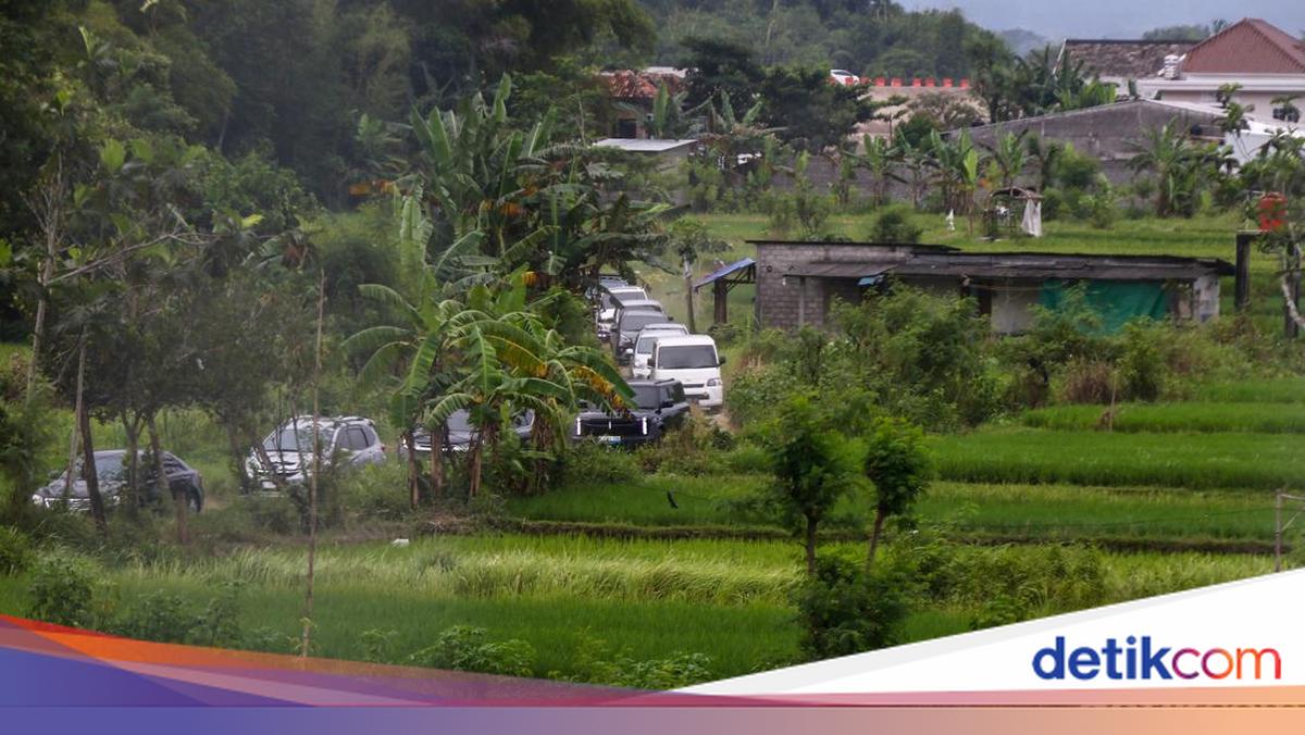
According to detikJogja, vehicles heading to the Purwomartani Toll Gate via rice paddy areas were dominated by private cars from out of town. Some drivers appeared confused about the direction to the toll gate.
Since 3:00 PM WIB, several vehicles began to be seen passing through the rice paddy areas. The road traversed was a dirt road that could only accommodate one vehicle. Meanwhile, on the arterial road, namely the Jogja-Solo Road, traffic flow was quite congested.
“Yes, following Google Maps. It directed to (the road through) the rice fields,” said Satrio, one of the travellers heading to Jakarta, to reporters on Tuesday (24/3/2026).
Satrio admitted to following the navigation directions until approaching the toll gate. There were no officers or direction signs when passing through there.
“Yes, no signs and no officers,” he said.
Another traveller, Damar, admitted to being hesitant when directed to enter the rice paddy road. However, he continued the journey because it was difficult to turn back.
“Yes, directed by Google Maps. The destination is indeed the toll. I was hesitant for a moment, but turning back was no longer possible,” he stated.
Meanwhile, another traveller, Haryono, chose to continue following the digital navigation because of the congested conditions on the Jogja-Solo Road.
“Because earlier from Tajem, I opened Google Maps, since the Adisucipto Solo Road was all red,” he said.