Geological Agency: Implementation of earthquake hazard maps, mitigation of the Lembang Fault
Bandung (ANTARA) - The Geological Agency of the Ministry of Energy and Mineral Resources (ESDM) is encouraging the implementation of earthquake hazard maps for the Lembang Fault and Greater Bandung area as a sustainable mitigation effort.
Senior Earth Investigator at the Geological Agency, Supartoyo, in Bandung on Thursday, explained that the hazard map has been prepared using various scientific approaches and is expected to be used as a basis for implementing mitigation efforts.
“This earthquake hazard map was prepared based on scientific studies, ranging from geomorphological analysis to microtremor measurements in the field. The main challenge is actually in the consistency of implementation,” he said.
According to him, the preparation of the map refers to regulations from the Ministry of ESDM, including Minister of ESDM Regulations Number 15 and 16 of 2011, so it can be a scientific basis in the preparation of spatial planning policies, the issuance of building permits, and infrastructure development.
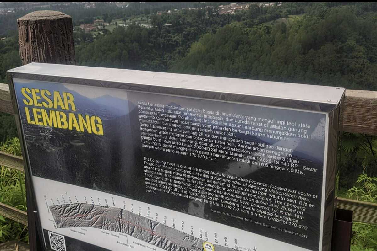
In addition to the probabilistic approach, the Geological Agency also conducts deterministic analysis by assuming that all segments of the Lembang Fault, which is approximately 29 kilometres long, move simultaneously.
In this scenario, he said, the earthquake has the potential to reach a magnitude of 6.8–7 with ground acceleration of up to 0.6–0.8 g.
“The results of this deterministic analysis are used as the worst-case scenario to support the preparation of regional contingency plans,” he said.
Supartoyo emphasised that the hazard map is not just a technical document, but an important instrument in long-term development decision-making.
He said that areas located directly on the surface fault line should be avoided for the development of vital infrastructure, while areas with high shaking potential should implement stricter earthquake-resistant construction standards.
In addition to structural mitigation, he also highlighted the importance of non-structural mitigation such as disaster education, periodic evacuation simulations, and the preparation of contingency plans involving local governments, the business world, and the community.
“The data and maps are available. What is needed now is a shared commitment to the implementation of mitigation,” he said.
According to him, without strict implementation in spatial planning and development supervision, the risk of earthquakes in the Greater Bandung area will remain high even though scientific studies have been carried out comprehensively.