Ciliwung Normalisation Targeted for 2029 as Kebon Pala Residents Wait for Clarity
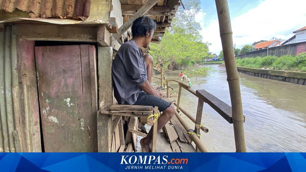
JAKARTA — The Jakarta Province Government (Pemprov DKI Jakarta) targets completion of the Kali Ciliwung normalisation project in 2029. The project is expected to be a long-term solution to floods that have haunted riverbank areas for decades, including Kebon Pala, Kampung Melayu, Jatinegara, in East Jakarta. Ibnu Affan, Head of the Water Resources Acquisition Unit of the DKI Jakarta Water Resources Agency (SDA), said the Kebon Pala area is part of the Kali Ciliwung normalisation plan in Kelurahan Kampung Melayu and is currently in the process of issuing a Location Determination (Penlok), with a Planning Land Acquisition Document Verification Team formed by the Governor. In addition to normalisation, the plan includes the construction of flood defences. He explained that parts of Kampung Melayu already have dyke structures built by the Ciliwung-Cisadane River Basin Office (BBWS) of the Ministry of Public Works, but the works are not yet fully completed. ‘Further land acquisition processes will be carried out to support the dyke construction,’ he said. Ibnu noted that flood-control infrastructure on Kali Ciliwung will be implemented gradually and continuously in priority locations. In the process, coordination between local government and communities has been maintained. He said communication with residents’ associations, including RT and RW, is facilitated by the local government. ‘Coordination and communication with RT/RW have been established well, facilitated by the kelurahan, kecamatan, and the Wali Kota East Jakarta, and in collaboration with BPBD DKI Jakarta,’ he said. Nevertheless, residents living along the Kali Ciliwung still have to wait several more years until the project is fully completed. ‘The normalisation and construction are expected to finish in 2029,’ he said. For Kebon Pala residents, flood histories are not new. Sanusi, head of RT 13 RW 04 Kebon Pala, said major floods began to occur more frequently since the mid-1990s. ‘The biggest flood was around 1996. Floods occurred before 1996, but not as severe,’ Sanusi told Kompas.com at his home on Tuesday, 3 March 2026. He noted that 2007 was among the worst events in Kebon Pala, with floods also recorded in 2002, 2013, and 2020. In recent years, he added, flood frequency has risen, with near-monthly floods during heavy rain from Bogor or persistent downpours here. Water on the street can reach up to two metres. The area is densely populated; RT 13 comprises around 96 households in 53 houses. He said many homes now have two to three storeys, driven by both flood risk and population density. ‘In one house two to four family heads live together, as married children usually stay here,’ he said. Nevertheless, the presence of upper floors also helps residents cope when floods rise. When floods strike, residents typically move belongings to upper floors; those with two- or three-storey homes often leave the ground floor submerged. ‘Many residents here run home-based businesses. If floods hit, they cannot sell,’ he said. In addition to loss of income, household items are often damaged. ‘Mattresses, clothes, and wardrobes are frequently ruined by immersion,’ he added. In some cases, floods arrive so quickly that residents have little time to save belongings. ‘If floods arrive suddenly without warning, many wardrobes topple and residents’ belongings are completely submerged,’ he said. A walk along the narrow alley in RT 13 RW 04 Kebon Pala reveals the contrast between daily life and the threat posed by Kali Ciliwung. For more than three decades floods have been part of life here, forcing residents to adapt amid uncertainty. A striking feature is utility poles and walls marked with water-height indicators; the red line at 200 centimetres bears silent testimony to how often the area has been submerged. The survival strategy is visible in the architecture: most buildings are two to three storeys high. For some residents, the ground floor is no longer the main living area during the rainy season.