BPBD Records 61 Neighbourhood Units and Six Road Segments Flooded in Jakarta
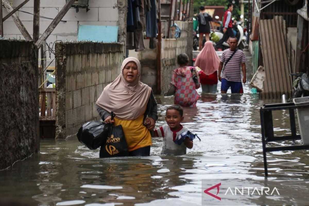
Jakarta (ANTARA) — The Jakarta Regional Disaster Management Agency (BPBD) recorded that 61 neighbourhood units (RT) and six road segments were inundated by flooding as of 07:00 Western Indonesian Time (WIB).
“BPBD has recorded that there are currently 61 neighbourhood units and six road segments flooded,” said Head of the BPBD Jakarta Disaster Data and Information Centre Mohamad Yohan in Jakarta on Friday.
He said three neighbourhood units in Kedaung Kali Angke subdistrict, West Jakarta, were hit by flooding with a depth of 30 centimetres, caused by heavy rainfall.
Additionally, 58 neighbourhood units in South Jakarta were affected, including one in Cilandak Barat with floodwaters reaching 50 cm, caused by heavy rainfall and the overflowing of the Krukut River.
Two neighbourhood units in Lebak Bulus experienced flooding of 20–60 cm depth, caused by heavy rainfall and the overflowing of the Grogol Mampang River.
Three neighbourhood units in Cipete Utara saw floodwaters reach 110 cm, caused by heavy rainfall and the overflowing of the Krukut River.
“Then, 39 neighbourhood units in Petogogan experienced flooding of 40–75 cm depth, caused by heavy rainfall, the overflowing of the Krukut River, and the overflowing of the Nipam connecting channel,” said Yohan.
A further two neighbourhood units in Cilandak Timur saw flooding reach 80–120 cm, caused by heavy rainfall and the overflowing of the Krukut River.
Five neighbourhood units in Bintaro experienced flooding of 40 cm depth, caused by heavy rainfall and the overflowing of the Pesanggrahan River.
Five neighbourhood units in Pesanggrahan experienced flooding of 60–70 cm depth due to heavy rainfall and the overflowing of the Uangan River, whilst one neighbourhood unit in Ulujami saw floodwaters reach 80 cm, also caused by heavy rainfall and the overflowing of the Uangan River.
In addition, six road segments were affected: Jalan Gaya Motor Raya in Kebon Bawang, North Jakarta, with a depth of 30 cm; Jalan Strategi Raya in Joglo, West Jakarta, at 30 cm; Jalan Basoka Raya in Joglo, West Jakarta, at 40 cm; Jalan Srengseng Raya in Srengseng, West Jakarta, at 20 cm; Jalan Ciledug Raya (in front of Shell petrol station) in Petukangan Selatan, South Jakarta, at 30 cm; and Jalan Pondok Karya in Pela Mampang, South Jakarta, at 60 cm.
BPBD Jakarta deployed personnel to monitor flooding conditions in each area and coordinated with the Water Resources Agency, Highways Agency, and the Fire and Rescue Service to pump out floodwaters and ensure drainage channels were functioning properly.
Together with local subdistrict and village heads, Yohan added, all agencies were also preparing basic necessities for flood survivors. The floodwaters were targeted to recede as quickly as possible.