BMKG Reveals Facts on El Niño to Police, Set to Hit Indonesia During Dry Season
Jakarta, CNBC Indonesia - The Indonesian Agency for Meteorology, Climatology, and Geophysics (BMKG) has reminded the government of the need to prepare for the El Niño climate phenomenon that will affect Indonesia. This includes mitigation measures and coordination between agencies.
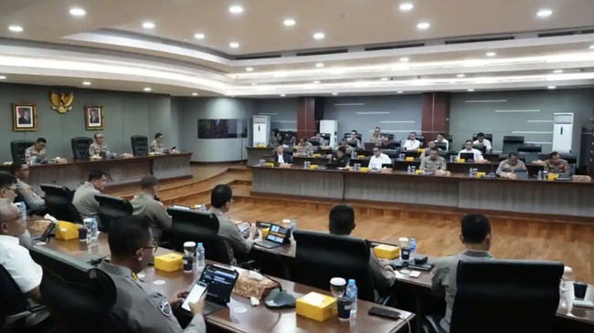
This was conveyed by BMKG Secretary-General Guswanto during the Coordination Meeting on Anticipating the El Niño Phenomenon, organised by the Indonesian National Police at the National Police Headquarters in South Jakarta on Tuesday (14/4/2026). The meeting aimed to strengthen cross-sectoral and cross-regional preparedness in the face of potential impacts from climate anomalies, particularly those that could increase the risk of forest and land fires (karhutla) during the 2026 dry season.
In the meeting, Guswanto outlined the development of global climate conditions. He stated that the current global climate is still in a neutral ENSO phase until mid-2026.
“However, BMKG’s analysis at the end of March 2026 indicates a tendency towards a transition to a weak to moderate El Niño phase in the second semester of 2026, with a probability ranging from 50 to 80 percent,” said Guswanto in a statement on the official website, quoted on Thursday (16/4/2026).
“Such conditions are potentially to affect the 2026 dry season, which is predicted to arrive earlier and last longer than normal,” he added.
BMKG noted that as of the First Decade of 2026, 7.8% of Indonesia’s regions (55 Seasonal Zones/ ZOM) have already entered the dry season.
The ZOM predicted to enter the dry season during the Second Decade of April to the First Decade of May 2026 include parts of Jambi, parts of South Sumatra, parts of Lampung, parts of Banten, parts of Jakarta, parts of West Java, parts of Central Java, parts of East Java, parts of Bali, parts of West Nusa Tenggara, parts of East Nusa Tenggara, parts of South Kalimantan, parts of South Sulawesi, and parts of Maluku.
On the other hand, Guswanto highlighted the recent buzz around the term “El Niño Godzilla”. He said that this term is not an official terminology in climatology or public communication.
“In communicating information to the public, BMKG consistently uses terms and scientific analysis based on data to describe climate conditions and potential developments accurately, objectively, and responsibly,” Guswanto stressed.
Preparedness for Karhutla
Meanwhile, Deputy National Police Chief Komjen Pol. Dedi Prasetyo, who led the meeting, reminded of the importance of cross-sectoral collaboration in facing the potential for karhutla.
“We ask all regional ranks to establish cooperation with related agencies. Involve all elements, from government services, volunteers, to academics, to strengthen handling on the ground,” said Dedi.
What is El Niño and its impact on Indonesia?
According to the official BMKG website, ENSO is an anomaly in sea surface temperatures in the Pacific Ocean along the west coast of Ecuador and Peru that is higher than the normal average.
It is stated that the climate in the Pacific Ocean is divided into three phases: El Niño, La Niña, and Neutral.
In the Neutral phase, trade winds blow from east to west across the Pacific Ocean, producing an ocean current that also moves westward, known as the Walker Circulation. The sea surface temperature in the western Pacific is always warmer than in the eastern Pacific.
Meanwhile, during the El Niño phase, the trade winds that normally blow from east to west weaken or even reverse direction. This weakening is associated with the expansion of warm sea surface temperatures in the eastern and central Pacific. The warm water shifting eastward causes evaporation, clouds, and rain to also shift away from Indonesia. This means Indonesia faces an increased risk of drought.
And when the La Niña phase occurs, the trade winds from the eastern Pacific to the west along the equator become stronger than usual. The strengthening trade winds push the mass of seawater westward, making the sea surface temperature in the eastern Pacific cooler. For Indonesia, this means a higher risk of flooding, lower daytime air temperatures, and more tropical storms.
“In current climate science terms, El Niño indicates a condition of anomalous sea surface temperatures in the eastern and central equatorial Pacific Ocean that are warmer than normal, while the anomalous sea surface temperatures in the western Pacific region and Indonesian waters, which are usually warm (warm pool), become cooler than normal,” writes BMKG.
“When El Niño occurs, the area of cloud development shifts from the Indonesian region to the central Pacific Ocean region, resulting in reduced rainfall in Indonesia,” explains BMKG.
Current Atmospheric Dynamics
Meanwhile, in the First Decade of April 2026 Atmospheric Dynamics Analysis released by BMKG on 13 April 2026, the monitoring results for the First Decade of April 2026 show the decadal IOD index (monthly index) at +0.15 (+0.023), indicating that the IOD phenomenon is in the Neutral phase.
“Meanwhile, the decadal ENSO index (monthly ENSO) at +0.28 (-0.01) shows that the ENSO phenomenon is also in the Neutral phase,” writes BMKG.
“The Neutral ENSO condition is predicted to enter the El Niño phase starting May-June-July 2026,” explains BMKG.
BMKG itself has issued an early warning for meteorological drought applicable for the Second Decade of April 2026. That is, a Caution classification for several districts in Aceh Province, East Nusa Tenggara, and Central Sulawesi. Alert for several districts in Aceh Province.
And there is no early warning in the Warning classification.