
Worst-Case Megathrust Scenario: Magnitude 9.2 Earthquake and Tsunami Over 10 Metres
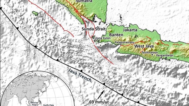
Jakarta, CNBC Indonesia — Indonesia lies in a region of high tectonic activity. Its geographical setting means that a number of areas in Indonesia and its surroundings contain subduction zones that could be sources of powerful earthquakes.
According to information shared by the Meteorology, Climatology and Geophysics Agency (BMKG) on Instagram, Indonesia’s 2024 Earthquake Source and Hazard Map lists 14 megathrust segments. The map was compiled using updated data and studies of earthquake sources in Indonesia and the surrounding region.
A megathrust is an earthquake source in a subduction zone, where two tectonic plates meet and one plate moves beneath the other. The boundary between the plates can become locked, allowing energy to build up.
When that stored energy is released, a powerful earthquake can occur along an extensive fault. BMKG says this is one of the earthquake sources that requires attention in Indonesia.
“Indonesia is in an active tectonic region and has several subduction zones that could be sources of strong earthquakes. A megathrust is an earthquake source in a subduction zone, where two tectonic plates interact,” BMKG wrote in an Instagram post on Wednesday, 23 September 2026.
According to the 2024 map, compiled by the National Centre for Earthquake Studies (PuSGeN), the 14 megathrust segments extend from western Sumatra and southern Java to eastern Indonesia and surrounding areas.
The first is the Aceh–Andaman Megathrust, with a maximum magnitude (Mmax) of 9.2. This is among the highest maximum magnitudes listed on the map.
The 14 megathrust zones or segments and their maximum magnitudes are:
Aceh–Andaman Megathrust — M 9.2
Nias–Simeulue Megathrust — M 8.7
Batu Megathrust — M 7.8
Mentawai–Siberut Megathrust — M 8.9
Mentawai–Pagai Megathrust — M 8.9
Enggano Megathrust — M 8.9
Java Megathrust — M 9.1
Western Java Megathrust — M 8.9
Eastern Java Megathrust — M 8.9
Sumba Megathrust — M 8.9
North Sulawesi Megathrust — M 8.5
Cotabato Trench Megathrust — M 8.3
Southern Philippines Megathrust — M 8.2
Central Philippines Megathrust — M 8.1
Although Mmax indicates the highest magnitude considered in earthquake-source modelling, it does not mean that an earthquake of that magnitude is certain to occur.
Mmax is part of modelling and research into the characteristics of each earthquake source. Megathrust zones should therefore be understood as part of the region’s tectonic conditions and earthquake hazard, which must be taken into account—not as a prediction of when an earthquake will occur.
Worst-case scenario
BMKG says the worst-case scenario if an Indonesian megathrust ruptures would involve a major earthquake and tsunami. For the Aceh–Andaman segment, an earthquake could reach magnitude 9.2 off Sumatra’s west coast. The tsunami could exceed three metres at the coastline and rise above 10 metres in some locations.
The maximum shaking could reach intensity VIII on the Modified Mercalli Intensity (MMI) scale. Everyone would feel it and people would run outdoors; light damage could occur, plaster could fall, and poorly constructed buildings could be damaged or collapse.
Source: jawawa.id (https://jawawa.id/newsitem/worst-case-megathrust-scenario-magnitude-9-2-earthquake-and-tsunami-over-10-metres-1791705026)
Originally published by CNBC Indonesia (https://www.cnbcindonesia.com/tech/20261010231013-37-775023/skenario-terburuk-megathrust-ri-pecah-gempa-m-92-tsunami-10-m-lebih), translated from Indonesian