
Why the Philippines and North Sulawesi Are Prone to Earthquakes and Tsunamis
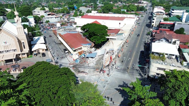
A number of regions in Indonesia were recently shaken by an earthquake, sparking a tsunami warning following a powerful quake in the Southern Philippines. The warning has since been officially lifted.
According to the official website of the Meteorology, Climatology and Geophysics Agency (BMKG), the tsunami alert ended around 10:15 WIB on Monday, 8 June 2026. BMKG stated that the early tsunami warning caused by a magnitude 7.7 earthquake at 06:37:42 WIB, located 224 kilometres northwest of Karatung Island, North Sulawesi, had concluded. A similar event occurred in October last year, when a major tectonic earthquake, updated to magnitude 7.4, shook the Philippine Sea region near the Talaud Islands, North Sulawesi, on Friday, 10 October 2025.
Earthquake expert and member of the Indonesian Association of Disaster Experts (IABI), Daryono, revealed several factors explaining why the Philippine Islands and North Sulawesi are prone to earthquakes and tsunamis. Firstly, the region lies within the Pacific Ring of Fire, an area with the world’s most active tectonic and volcanic activity, making earthquakes, volcanic eruptions, and tsunamis frequent occurrences. Furthermore, the Philippine Islands and North Sulawesi are a meeting point for several major tectonic plates, including the Eurasian Plate, the Philippine Sea Plate, the Molucca Sea Plate, and the influence of the Pacific Plate. The convergence of these plates causes pressure and shifting of the earth’s crust, triggering quakes both on land and at sea.
Another primary cause of strong earthquakes is subduction activity, the process where one plate slides beneath another. The Philippines and North Sulawesi feature several active subduction zones, including the Philippine Trench, the Cotabato Trench, the North Sulawesi Trench, and the Sangihe Trench. These subduction zones are capable of producing large earthquakes with tsunami potential. The area also possesses a highly complex tectonic structure because the plates move in different directions, their relative speed is high, and small micro-plates interact with each other. This condition causes stress accumulation in the earth’s crust to occur more quickly and is frequently released in the form of earthquakes.
Daryono further explained that many earthquake epicentres are located in the deep sea. When a strong underwater earthquake occurs, a sudden shift in the seabed can displace a massive volume of water and trigger a tsunami. Seismic activity in the Maluku Sea, Sulawesi Sea, and off the coast of Mindanao often prompts early tsunami warnings for both Indonesian and Philippine territories. Many earthquakes in the Philippines and North Sulawesi are shallow to intermediate in depth, meaning their tremors are felt more strongly at the surface. If the magnitude is large and occurs at sea, the tsunami potential increases. Due to their close geographical proximity, strong earthquakes in the Philippine Sea and off the coast of Mindanao can affect Indonesian regions, particularly North Sulawesi, North Maluku, and North Kalimantan. Tsunami waves and strong earthquake vibrations can propagate across national borders.