
What to Know About EroSlide, BRIN's New Landslide Detection System
What to Know About EroSlide, BRIN’s New Landslide Detection System
Reporter
September 4, 2026 | 10:37 am
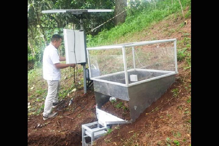
TEMPO.CO, Jakarta - Researchers from the National Research and Innovation Agency (BRIN) have invented a new system to detect potential erosion and landslides, dubbed EroSlide. The early warning system relies on a combination of various sensors, including data on rainfall, weight of sediment deposits, water flow rate, site slope, soil pH and moisture, as well as temperature.
Principal Expert Engineer at the BRIN Mineral Technology Research Center, Nendaryono Madiutomo, said EroSlide is an acronym for “erosion, sliding, and deposition.”
“Erosion is the root cause of landslides,” he told Tempo in Bandung on Wednesday, September 2, 2026.
According to Nendaryono, the combination of EroSlide sensors is reinforced with data processors, transmission networks, data, batteries, and solar panels.
A team of 15 researchers from various research centers at BRIN placed all sensors in a 1 x 1 x 1 cubic meter box chamber. “This size represents areas with similar land characteristics such as slope and soil type,” he said.
All captured sensor data will be forwarded and analyzed by a data logger, a term for a dedicated mini computer. This system will send processed data results to users via 4G or 5G cellular networks. For locations without cell phone signals, the team has prepared a combination of radio modem transmissions.
Nendaryono claims that EroSlide can automatically send data from locations potentially affected by erosion, landslides, or depositions. The data collection interval can be adjusted as needed, ranging from daily, hourly, and per minute, to seconds. “Results can be displayed in tabular or real-time graphical form,” he added.
EroSlide data can also be used to classify regional conditions, such as areas with specific rainfall categories or erosion levels. The BRIN team is also optimistic that the same data can support the development of erosion, landslide, and deposition potential maps.
EroSlide categorizes hazards by color, with green indicating safety, yellow for caution, and red to call for evacuation. Nendaryono ensures that similar categorization can also be rung through siren.
This early warning system for erosion and landslides has been tested in Bandung for 10 months, from September 2025 to June 2026. The team will continue to run the trial in Subulussalam, Aceh, in October or at the latest in November.
Read: How Far Along Is Indonesia’s Food Spoilage Scanner for Free Meals?
Click here to get the latest news updates from Tempo on Google News