
West Sumatra Floods Recede: Emergency to Recovery Transition Status Declared
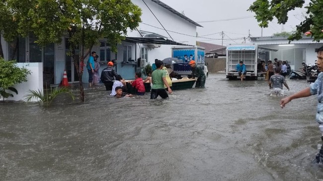
The Provincial Government of West Sumatra (Pemprov Sumbar) has maintained a Transition Status from Emergency to Disaster Recovery for floods, flash floods, landslides, and strong winds, as flooding that hit a number of areas begins to recede. This status was established based on the Decree of the Governor of West Sumatra Number 360-195-2026, which is valid until 18 September 2026. Abdul Muhari, Head of the Data, Information, and Communication Centre for Disasters at the National Disaster Management Agency (BNPB), stated that flood conditions in several affected areas have gradually subsided, based on data updates as of Tuesday (4/8/2026) at 14.30 WIB. “As the inundation recedes, residents are beginning to return to their respective homes and carry out post-flood environmental clean-ups,” Muhari said, cited from a press release today. BNPB urged the public to remain vigilant regarding the potential for extreme weather that may still occur. Residents are expected to follow official information from the Meteorology, Climatology, and Geophysics Agency (BMKG) and local governments, avoid activities in flood-prone areas during heavy rain, and immediately report emergency conditions to officers if there is a potential threat of disaster for the sake of collective safety. As is known, the flooding in West Sumatra was triggered by very high-intensity rain that drenched the Padang City area on Monday (3/8), from around 11.00 WIB to 17.00 WIB. The high rainfall caused several rivers to overflow and inundate residential areas with water levels reaching approximately 150 centimetres at several points. Affected areas include the sub-districts of Kuranji, Koto Tangah, Bungus Teluk Kabung, Lubuk Begalung, and Nanggalo, covering a number of wards such as Gunung Sarik, Pasar Lalang, Rimbo Tarok, Kuranji, Sungai Sapih, Aia Pacah, Koto Panjang Ikua Koto, Bungus Selatan, Teluk Kabung Utara, Pagambiran Ampalu Nan XX, to Surau Gadang. Data collection on the impact of the floods, including casualties and material losses, is still being carried out by officers in the field.