
West Kalimantan Entrepreneur Donates Technology to Predict Forest and Land Fires Up to 24 Months Ahead
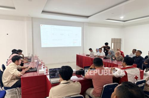
The National Disaster Management Agency (BNPB) has recorded thousands of hotspots detected across several regions of Kalimantan that are still facing the threat of forest and land fires (karhutla). West Kalimantan is one of the areas with the largest indication of burned land, followed by South Kalimantan and Central Kalimantan.
Acting Head of the BNPB Disaster Data, Information and Communication Centre, Berton SP Panjaitan, said that 2,610 hotspots and 64 firespots were detected in West Kalimantan. The indication of burned land area reached more than 38,310 hectares, with visibility in several areas reported to be less than one kilometre.
“To date, we report that in West Kalimantan the hotspots found and reported to us number 2,610,” said Berton during a press conference broadcast via the BNPB YouTube channel on Wednesday (26/8/2026).
“Meanwhile, firespots number 64 points. The indication of burned area is more than 38,310 hectares. Visibility is around below 1 km,” he added.
Berton said rain had fallen in several districts in West Kalimantan since Tuesday (25/8). The rain was the result of weather modification operations carried out as one of the efforts to handle forest and land fires.
Meanwhile, BNPB recorded 2,110 hotspots in Central Kalimantan. Of that number, there were 55 firespots with an indication of burned land area reaching more than 7,634 hectares, while visibility in the region remained normal at more than 10 kilometres.
“In Central Kalimantan, we found 2,110 hotspots, while firespots number 55 points. The indication of burned land is more than 7,634 hectares. Visibility is normal at above 10 km,” said Berton.
In South Kalimantan, BNPB detected 817 hotspots and 1,995 firespots. The indication of burned land area in the province reached more than 9,605 hectares, while visibility was reported to be above nine kilometres.
The data shows that handling forest and land fires requires not only extinguishing fires once they have occurred, but also strengthening prevention and mitigation efforts. A data-based approach is considered able to help the government and stakeholders identify areas with higher risk levels.
One of the efforts to strengthen prevention is being carried out through the use of artificial intelligence (AI) technology. A West Kalimantan entrepreneur and technology developer, Hajon Mahdy, through Hotama Technologies, has developed an AI-based system to help map and predict the risk of forest and land fires.
The system is designed using a predictive analytics approach by processing various variables and data to produce risk-level mapping for forest and land fires over a specific period. The technology is projected to be able to provide a risk picture up to 24 months ahead as supporting information for decision-making.
Source: jawawa.id (https://jawawa.id/newsitem/west-kalimantan-entrepreneur-donates-technology-to-predict-forest-and-land-fires-up-to-24-months-ahead-1787835165)
Originally published by Republika (https://republika.co.id/berita//tkfe3w451/pengusaha-kalbar-hibahkan-teknologi-prediksi-karhutla-hingga-24-bulan), translated from Indonesian