
Unlike Land Borders, Maritime Borders Have Potential to Connect with Multiple Countries
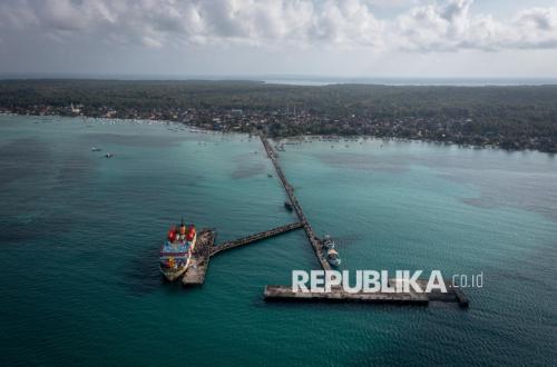
The Assistant Deputy for Maritime and Air Border Management of the Indonesian National Border Management Agency (BNPP RI), Gutmen Nainggolan, has asserted that the characteristics of maritime borders demand a different management approach compared to land borders. Maritime border areas possess the potential for cross-border connections with more than one country, meaning spatial planning must consider aspects of connectivity, sovereignty, and transnational interests.
“The characteristics of maritime borders differ from land borders. Cross-border flows in maritime areas can connect with more than one country, so the management approach must be broader,” he stated during discussions regarding the agreement on the delineation of Planning Areas (WP) for the preparation of the Detailed Spatial Plan for National Border Areas (RDTR KPN) in Maritaing, East Nusa Tenggara (NTT), and Toli-Toli, Central Sulawesi, between BNPP RI and the Ministry of ATR/BPN on Monday (5/10/2026).
According to him, the RDTR KPN for Maritaing and Toli-Toli needs to be placed within a border area management framework that integrates interests of sovereignty, security, development, and community welfare.
“This RDTR is vital to ensure that development in border areas proceeds according to the established strategic targets, regarding defence and security, community welfare, as well as sustainable development,” said Gutmen.
Gutmen emphasised that the preparation of the RDTR KPN must also consider the dynamics of international boundary settlements and plans for the construction of Integrated Border Posts (PLBN). The determination of PLBN locations, he noted, requires coordination with neighbouring countries as counterparts to ensure the suitability of construction points and cross-border access.
Specifically for Maritaing, the plan to develop a PLBN is being pushed to be included in the third phase of PLBN construction. However, this plan must consider regional conditions, including the potential for extreme sea waves during certain seasons, as part of a comprehensive mapping within the development planning.
Meanwhile, Toli-Toli is one of the areas included in the priority for maritime area development during the 2025–2029 National Medium-Term Development Plan (RPJMN) period.
The Director of Spatial Planning at the Ministry of ATR/BPN, Nuki Harniati, stated that the preparation of the RDTR KPN for Maritaing and Toli-Toli is part of the spatial planning of border areas which falls under the authority of the central government. Nevertheless, the preparation process still requires the involvement of local governments and relevant stakeholders.
Nuki explained that Maritaing and Toli-Toli possess different characteristics compared to land border areas such as Wini, Motaain, and Motamasin, which directly border Timor-Leste.
As maritime border areas, both regions require attention to the management of coastal spaces and areas facing neighbouring countries. “Although the RDTR KPN is under the authority of the central government and involves defence and security interests, coordination with local governments remains necessary so that spatial utilisation regulations are aligned with regional development policies and community needs,” said Nuki.
She explained that the preparation of the RDTR KPN utilises three main approaches: security, prosperity, and environment. The security approach places defence and security as the primary concern, prosperity is directed towards increasing community welfare, while the environment approach ensures that spatial utilisation continues to respect environmental sustainability.
Nuki added that the determination of area delineation considers various criteria, including defence and security aspects. The plan to develop national gateways, or PLBN, can serve as one of the bases for determining planning areas and their surrounding zones.
“Input from BNPP RI and local governments is highly necessary, regarding administrative boundaries, border management policies, regional potential, development plans, and environmental conditions,” she said.
The forum is expected to result in an agreement on the delineation of the Maritaing and Toli-Toli Planning Areas while strengthening the substance of the RDTR KPN.