UGM Expert Explains the Mindanao Earthquake
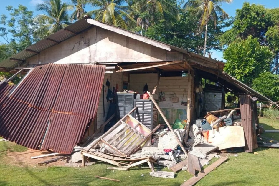
A magnitude 7.7 earthquake that shook the Mindanao Sea in the Philippines on Monday (8/6) serves as a reminder that the Southeast Asian region is situated in a highly active tectonic environment. Lecturer in Geology at the UGM Faculty of Engineering, Ir. Gayatri Indah Marliyani, S.T., M.Sc., Ph.D., IPM., explained that the earthquake is a common type occurring in areas where tectonic plates meet, such as the Philippines and Indonesia. In the Mindanao Sea region, there is a subduction zone, an area where one tectonic plate plunges beneath another. “This subduction process takes place very slowly, only a few centimetres per year, but energy continues to accumulate over tens to hundreds of years,” she explained on Thursday (11/6). According to her, the relationship between stress and earthquakes can lead to a point where the stored stress exceeds the strength of the rock, causing the fault plane to fracture and move suddenly, thus generating an earthquake. In a thrust fault mechanism, Gayatri noted, one block of rock is pushed against another due to compressional forces. She cautioned that when such movement occurs under the sea and causes a sudden uplift or subsidence of the seabed, the water column above it is also displaced, which can generate tsunami waves. “The combination of a large magnitude, an offshore earthquake source, a relatively shallow depth, and a thrust fault mechanism are conditions that warrant caution regarding tsunami potential,” she stated. Furthermore, she explained that the main cause of the earthquake was tectonic activity in the Mindanao Sea subduction zone. The earthquake source did not originate from a single land fault extending to Sulawesi but rather from the movement of tectonic plates that are active in the region. Tremors could be felt as far away as Sulawesi because the seismic wave energy from a large earthquake can propagate hundreds to thousands of kilometres from its source. “The larger the earthquake magnitude, the wider the area that can feel the shaking,” she said. She added that the epicentre location and earthquake depth play an important role in determining tsunami potential. Earthquakes occurring under the sea have a greater chance of generating a tsunami compared to earthquakes on land. However, magnitude alone is insufficient to determine whether a tsunami will occur, as the fault mechanism and the extent of seabed deformation are also determining factors. Gayatri stated that the Mindanao earthquake serves as a reminder for Indonesia, which is similarly located in the Pacific Ring of Fire. She stressed that Indonesia has many sources of large earthquakes, both from subduction zones in Sumatra, Java, Nusa Tenggara, Maluku, and Sulawesi, as well as from active faults on land. However, the Mindanao earthquake does not mean it will directly trigger a large earthquake in Indonesia. This is because each earthquake source has its own characteristics and cycles. “What is more important is to use this event as momentum to improve preparedness,” she said. Indonesia has a long history of earthquakes and tsunamis, so there is a need to understand that these threats are real risks that must be faced together. “The most important thing is to build a disaster-aware culture. Vigilance does not mean living in fear. With good knowledge and appropriate responses, risks can be reduced and more lives can be saved when a disaster occurs,” she concluded.