
Sumatra Surrounded by 1,195 Hotspots
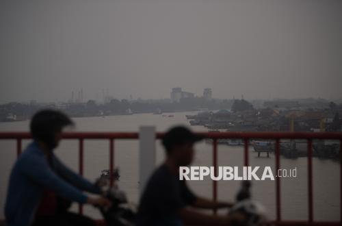
The Meteorology, Climatology and Geophysics Agency (BMKG) Pekanbaru Station has detected 1,195 hotspots spread across the island of Sumatra. Of this total, 198 hotspots are located in Riau Province, placing it second after South Sumatra, which recorded 454 hotspots.
BMKG Pekanbaru forecaster Putri Santy S stated that based on the latest monitoring data, South Sumatra is the province with the highest number of hotspots in Sumatra, followed by Riau. “There are a total of 1,195 hotspots in Sumatra. Riau accounts for 198 of them,” she said in a statement in Pekanbaru on Sunday (9/8/2026).
Besides South Sumatra and Riau, hotspots were also detected in several other provinces in Sumatra, namely Aceh with 11 hotspots, Bengkulu 17, Jambi 116, Lampung 127, North Sumatra 59, West Sumatra 43, Bangka Belitung 15, and the Riau Islands 12.
In Riau, Indragiri Hulu Regency became the area with the highest number of hotspots, totalling 98. This was followed by Bengkalis with 38 hotspots and Rokan Hilir with 28. Other hotspots were spread across Indragiri Hilir with eight, Rokan Hulu eight, Siak six, Dumai City five, Pelalawan four, and the Meranti Islands, Kampar, and Kuantan Singingi with one hotspot each.
Amid the high number of hotspots, efforts to extinguish forest and land fires (karhutla) are still being carried out in several areas of Riau. One location is in Kerumutan Village, Kerumutan District, Pelalawan Regency, where the burned area has reached 64 hectares. Forest and land fires have also occurred in Sungai Guntung Hilir Village, Indragiri Hulu Regency, with a burned area reaching 50 hectares. Another location is in Pematang Pudu Village, Mandau District, Bengkalis Regency, where the burned land area has reached 10 hectares.