
Spatial Planning Mismatch Worsened Hydrometeorological Disasters in Sumatra, Says Environment Ministry
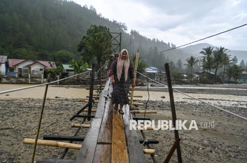
The Ministry of Environment has indicated that a high level of spatial utilisation mismatch with environmental carrying capacity was a key factor worsening the impact of hydrometeorological disasters in Aceh, North Sumatra, and West Sumatra last year. Deputy for Environmental and Sustainable Natural Resources Management, Sigit Relianto, stated that the ministry’s analysis shows parts of the three provinces are already experiencing environmental stress, even though overall population carrying capacity appears sufficient. “In terms of carrying capacity, these provinces are actually still adequate,” Sigit said during a media discussion in Jakarta on Tuesday.
Based on the ministry’s calculations, Aceh has the capacity to support approximately 14.41 million people, while its current population is around 5.48 million. North Sumatra can support about 23.65 million people with a population of roughly 15.39 million, and West Sumatra has a capacity of about 8.8 million people with a population of around 5.7 million. However, Sigit noted that these figures do not necessarily reflect good environmental quality. Analysis of carrying capacity based on water availability shows low levels, while the carrying capacity of coastal areas, particularly to support food security, has also come under pressure.
Sigit explained that coastal areas in Aceh and North Sumatra show indications of ecosystem damage that could reduce their ability to support community food security. The ministry combined various spatial data, including ecosystem maps, protected areas, forest areas, and other information to assess the suitability of spatial utilisation with environmental capability. The analysis revealed that approximately 59.23 percent of Aceh’s territory is in a condition incompatible with environmental carrying capacity. In North Sumatra, the figure reaches 32.14 percent, while in West Sumatra it is 41.67 percent.
Based on these findings, the ministry has submitted recommendations to the Ministry of Agrarian Affairs and Spatial Planning/National Land Agency to serve as material for evaluating and improving spatial plans. Sigit explained that the recommendations categorise areas into three management zones: avoid, minimise, and restore. Cultivation areas recommended for the ‘avoid’ category, where new development should be halted, cover approximately 88,000 hectares in Aceh, 172,000 hectares in North Sumatra, and 61,000 hectares in West Sumatra.