
South Kalimantan Reports Zero Hotspots, Forest Fire Control Strengthened in West and Central Kalimantan
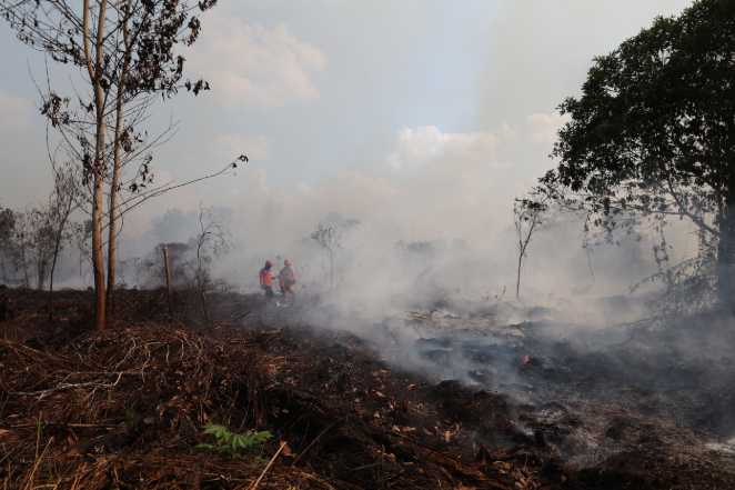
The Ministry of Forestry, alongside joint teams, is strengthening the control of forest and land fires (karhutla), especially in regions still showing high concentrations of hotspots. West Kalimantan and Central Kalimantan are the primary focus, while South Kalimantan has recorded zero hotspots with high confidence.
Based on SiPongi data from the Ministry of Forestry, sourced from NASA Terra/Aqua, SNPP, and NOAA-20 satellites as of Wednesday (9/9) at 21:04 WIB, 395 high-confidence hotspots were detected nationally. This figure represents a decrease of two points from the previous day. Among the six priority provinces for fire control, the highest number of high-confidence hotspots was recorded in West Kalimantan with 134 points, followed by Central Kalimantan with 81 points. South Sumatra recorded 35 points, Riau 15, Jambi four, while South Kalimantan recorded none.
“West Kalimantan and Central Kalimantan are areas of concern because they still show quite a high concentration of hotspots. Control is being continuously strengthened through patrols, ground checks, ground-based firefighting, as well as support from aerial operations,” said the Head of the Bureau of Public Relations and International Cooperation of the Ministry of Forestry, Ristianto Pribadi, on Thursday (10/9).
He noted that the absence of high-confidence hotspots in South Kalimantan is a positive development. However, this does not mean vigilance can be lowered, as fire situations can change according to weather conditions and available fuel on the ground. Ristianto explained that a hotspot is an indication of surface temperature anomalies detected by satellites and does not immediately signify a single fire event; one fire can also be detected as multiple hotspots.
“Therefore, every indication of a hotspot still needs to be verified through direct inspection or ground checks to ensure the actual conditions on the ground,” he said.
The Ministry of Forestry’s Manggala Agni, alongside the TNI, Polri, BNPB, BMKG, BPBD, local governments, the business community, and other stakeholders, continues to conduct patrols, ground checks, direct firefighting, fire spread containment, mopping up, and cooling operations. Aerial support is also on standby, with 5erm 53 aircraft deployed to support fire control in the six priority provinces. 19 aircraft are used for aerial patrols and supporting Weather Modification Operations (OMC), while 34 aircraft are dedicated to water bombing operations.
“The deployment of aerial operations is adjusted to the development of hotspots, field verification results, fire conditions, and meteorological conditions. OMC also remains on standby to utilise cloud potential for rain formation and to assist in wetting the land,” he added. Specifically for peatlands, wetting and cooling operations continue because embers can persist beneath the surface even when flames are no longer visible.
In addition to monitoring hotspots, the government is also monitoring air quality and smoke dispersion. PM2.5 monitoring shows that air conditions in Indonesia vary; most regions are in the good to moderate category, but several areas in Kalimantan are monitored in the unhealthy to very unhealthy category, with some areas even reaching the hazardous category.
Based on BMKG flight meteorology monitoring on Wednesday (9/9) afternoon, visibility in Pontianak was recorded at approximately 2 kilometres amidst smoky conditions. Palangka Raya recorded 4.5 km, Palembang 5 km, Pekanbaru 4 km, and Jambi 3 km, all under smoky conditions. Meanwhile, Banjarmasin had a visibility of approximately 9 km with clear, partly cloudy conditions.
“Visibility conditions are dynamic and can change following smoke concentration, wind direction and speed, humidity, rain, and the development of fires on the ground,” said Ristianto.
The Ministry of Forestry and all related parties continue to monitor hotspots, fire conditions, air quality, smoke dispersion, weather, rainfall, and visibility as the basis for determining future operational priorities. The public is urged not to clear land using burning methods and is requested to report any smoke, fire spots, or indications of fire immediately for prompt action.
Source: jawawa.id (https://jawawa.id/newsitem/south-kalimantan-reports-zero-hotspots-forest-fire-control-strengthened-in-west-and-central-kalimantan-1789023156)
Originally published by Media Indonesia (https://mediaindonesia.com/humaniora/931836/kalsel-nihil-titik-panas-pengendalian-karhutla-kalbar-kalteng-diperkuat), translated from Indonesian