
Shaken by 7.8 Magnitude Earthquake: A Timeline of the Deadliest Earthquakes in the Philippines
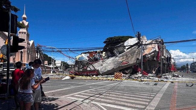
A magnitude 7.8 earthquake occurred off the southern coast of the Philippines on Monday (8/6/2026). The United States Geological Survey (USGS) and regional warning centres issued tsunami warnings following the event.
“The offshore earthquake occurred at a depth of 35 kilometres (22 miles) off the coast of Mindanao Island,” the USGS reported, with the tremor occurring at approximately 07:22 WIB. The Pacific Tsunami Warning Centre issued a notification stating that tsunami waves could occur within the next three hours. The threat extended beyond the Philippines, with tsunami warnings issued for the coasts of Indonesia, Palau, Taiwan, and Papua New Guinea.
So far, eight deaths have been reported in the Philippines due to the earthquake, with four others injured.
The Philippines’ Vulnerability to Earthquakes
The Philippines is situated along the Pacific Ring of Fire, a 40,000-kilometre arc filled with active tectonic faults and volcanoes. This region hosts more than half of the world’s active volcanoes and frequently experiences high-magnitude earthquakes. Major earthquakes in the Philippines since the 1960s have ranged from magnitude 6.1 to 7.9, resulting in fatalities ranging from 6 to approximately 8,000 people.
A History of Major Earthquakes in the Philippines:
Moro Gulf Earthquake (1976): Occurring in southern Mindanao with a magnitude of 7.9, this remains the most devastating earthquake in Philippine history in terms of both magnitude and loss of life. The disaster claimed up to 8,000 lives. Most victims were swept into the sea by a tsunami, with many reportedly lost to sharks. The earthquake and tsunami struck while residents were asleep, leaving them with no warning.
Luzon Earthquake (1990): On 16 July 1990, a powerful 7.8 magnitude earthquake struck northern Luzon. The quake caused widespread infrastructure damage and hundreds of deaths. The hardest-hit areas included Baguio, Dagupan, and Cabanatuan, where the collapse of high-rise buildings led to over 2,000 fatalities.
Aurora Earthquake (1968): The third strongest earthquake occurred in 1968 with a magnitude of 7.3, centred in Casiguran, Aurora. The tremors were felt as far as Manila, where the six-storey Ruby Tower collapsed, killing 271 people instantly.
Bohol Earthquake (2013): A 7.2 magnitude earthquake struck Bohol Island on 15 October 2013. The disaster killed over 220 people, injured approximately 900, and damaged thousands of buildings, including several historic Spanish-era churches. The quake also triggered landslides and revealed a new active fault known as the Inabanga Fault.
Cebu Earthquake (2025): A 6.9 magnitude earthquake struck the Cebu region on 30 September 2025, becoming the deadliest earthquake in the country since 2013. The disaster resulted in 72–79 deaths and over 1,200 injuries, destroying thousands of homes, churches, hospitals, roads, and bridges. Centred near Bogo City, the quake triggered landslides, power outages, and communication disruptions, displacing tens of thousands of residents. While a tsunami warning was briefly issued, it was eventually rescinded.
This recent event serves as a stark reminder of the high disaster risk within the Pacific Ring of Fire, an active seismic pathway that also traverses Indonesia.