
Several Volcanoes Erupt Simultaneously in Indonesia, Here Is the List
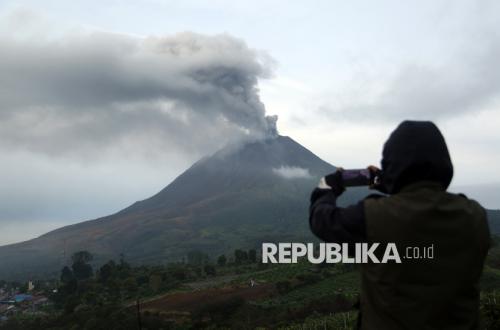
Volcanic activity at a number of volcanoes in Indonesia has increased throughout August into early September 2026. The Centre for Volcanology and Geological Hazard Mitigation (PVMBG) has recorded five volcanoes at Level III, or Alert, whilst 22 others stand at Level II, or Caution.
Disaster status data from the Ministry of Energy and Mineral Resources (ESDM), updated in early September, recorded no volcanoes at Level IV, or Warning. A total of 42 volcanoes remain at Level I, or Normal.
The five volcanoes currently at Level III, or Alert, are Mount Anak Krakatau, Mount Semeru, Mount Merapi, Mount Lewotobi Laki-laki and Mount Sinabung. This status indicates a marked increase in volcanic activity based on visual and instrumental monitoring, or that the volcano is currently erupting.
Meanwhile, the 22 volcanoes at Level II, or Caution, during this period include Awu, Banda Api, Bromo, Bur Ni Telong, Dempo, Dieng, Dukono, Gamalama, Ibu, Ile Werung, Ili Lewotolok, Iya, Karangetang, Kerinci, Lokon, Marapi, Raung, Rinjani, Sangeangapi, Slamet, Soputan and Talang. This list reflects the Level II status during the period summarised, as volcano alert levels may change at any time according to PVMBG evaluations.
Sinabung
The most notable change at the end of August occurred at Mount Sinabung in Karo Regency, North Sumatra. The Geological Agency raised Sinabung’s status from Level II, or Caution, to Level III, or Alert, on 31 August 2026 at 12.30 WIB. The decision was taken after the volcano erupted with an ash column reaching approximately 3,500 metres above the summit, or around 5,960 metres above sea level.
The eruption occurred at around 10.17 WIB. The thick, black ash column drifted eastwards to south-eastwards. Seismograph recordings showed a maximum amplitude of 120 millimetres with a duration of more than one hour in initial observations.
The National Disaster Management Agency (BNPB) recorded that the eruption had a direct impact on local communities. On 1 September, around 211 families, or 615 people, from Kuta Tengah Village evacuated to the emergency handling post in Sukatepu Village. Of these, 405 people are currently sheltering at the Jambur Arih Ersada Evacuation Post in Sukatepu Village, Naman Teran District.
The regional government has also directed residents to leave the danger zone and distributed masks to those affected by volcanic ash.
The Geological Agency described the 31 August event as an initial eruption and did not rule out a further increase in activity. As a result, residents are prohibited from carrying out activities in villages that have been relocated, within a three-kilometre radius of the summit, and in certain sectors extending up to six kilometres towards the south and south-east.
Mount Anak Krakatau…