
Semeru Lahar Flood Vibration Recorded for Six Hours
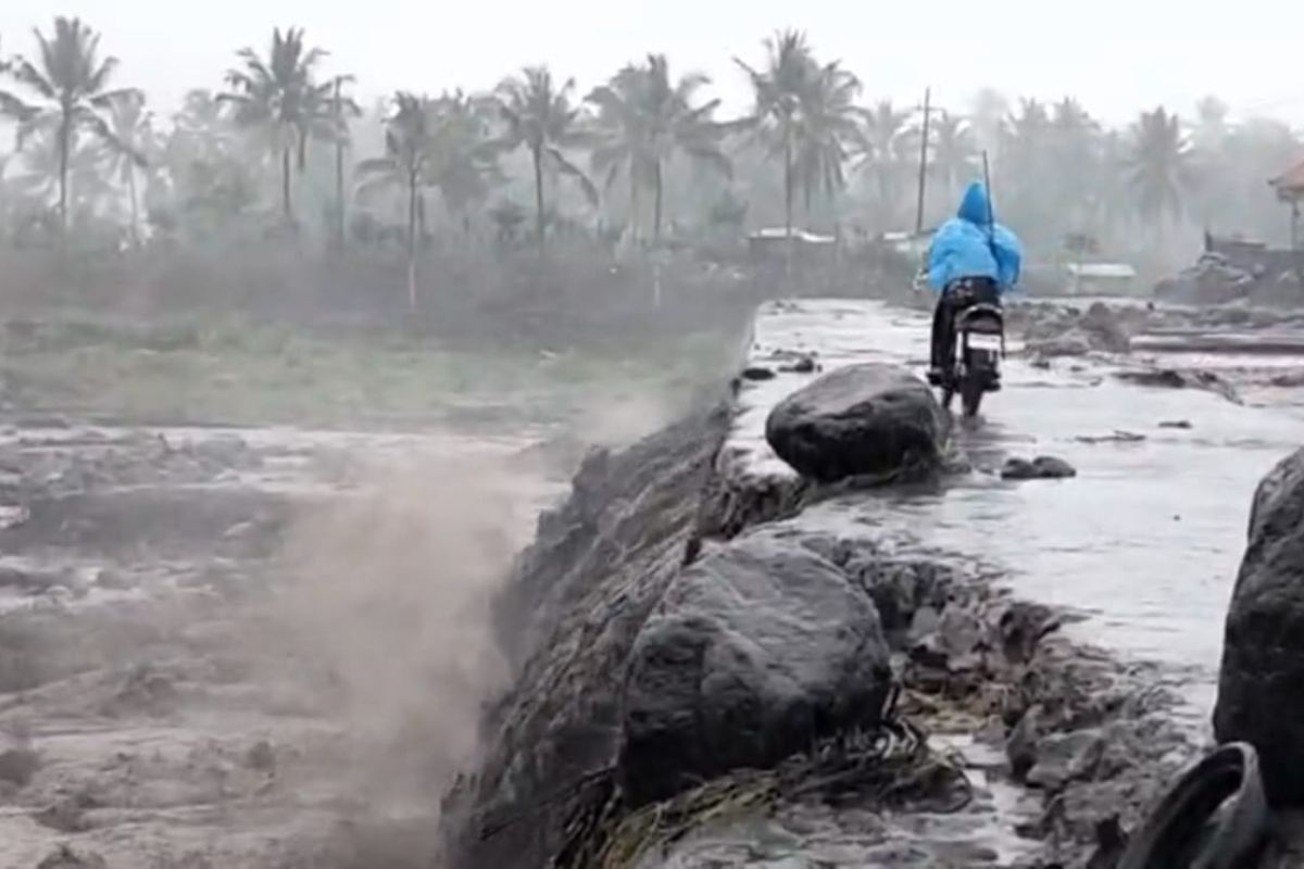
Lumajang, East Java (ANTARA) – The Mount Semeru Observation Post in Lumajang regency, East Java, recorded a lahar-flood vibration lasting six hours following heavy rain on Monday.
“During the observation period from midnight to 6am on Monday, one lahar-flood vibration earthquake was recorded, with an amplitude of 65 millimetres and a duration of 21,600 seconds, or six hours,” Mount Semeru Observation Post officer Agastya Rajendra said in a written report received in Lumajang.
In addition to the flood vibration, seismic activity over the previous six hours included one rockfall earthquake, with an amplitude of 6mm and a duration of 115 seconds, and 14 eruption earthquakes, with amplitudes of 10–25mm and durations of 31–153 seconds.
“Visually, Mount Semeru was obscured by fog and no crater smoke was observed. The weather was rainy, with light winds blowing west and north-west, and air temperatures of around 19–21 degrees Celsius,” he said.
He explained that Mount Semeru was at Volcanic Activity Level III (Alert). The Centre for Volcanology and Geological Hazard Mitigation (PVMBG) had therefore issued several recommendations, including that the public must not undertake any activities in the south-eastern sector along Besuk Kobokan, up to 13 kilometres from the summit, the eruption centre.
Beyond that distance, people must stay at least 500 metres from the riverbanks along Besuk Kobokan, as the area could be affected by an expanded reach of hot clouds and lahar flows, extending up to 17 kilometres from the summit.
“People are also prohibited from carrying out activities within a five-kilometre radius of Mount Semeru’s crater or summit because of the risk of ejected rocks, including incandescent rocks,” he said.
Residents should remain alert to the risk of hot clouds, lava avalanches and lahars along rivers and valleys originating at Mount Semeru’s summit, particularly along Besuk Kobokan, Besuk Bang, Besuk Kembar and Besuk Sat, as well as the risk of lahars in small rivers that are tributaries of Besuk Kobokan.
Information gathered in the field indicated that six hours of heavy rain at Mount Semeru had increased water flows in several Semeru river basins, causing an embankment to collapse in Purorejo village, Tempursari district, Lumajang regency.
Source: jawawa.id (https://jawawa.id/newsitem/semeru-lahar-flood-vibration-recorded-for-six-hours-1793587931)
Originally published by Antara (Indonesian) (https://www.antaranews.com/berita/5825539/getaran-banjir-lahar-semeru-terekam-selama-enam-jam), translated from Indonesian