
Semeru Fire Spreads, 1,888 Hectares of Land Burnt
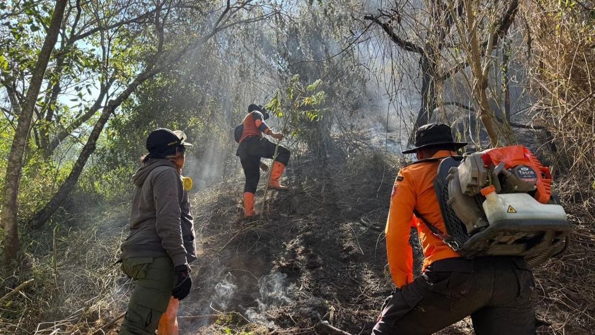
Forest and land fires (karhutla) in the Mount Semeru area, Lumajang Regency, East Java, have now reached approximately 1,888.91 hectares as of Friday (4/9) at 12:00 WIB.
Satriyo Nurseno, Head of Emergency and Logistics at the East Java BPBD, stated that this burnt area figure is preliminary data and is subject to increase. “The burnt area is 1,8_88.91 hectares, and the data is still developing,” Satriyo said in a written report on Friday.
Satriyo continued, noting that fire hotspots are currently concentrated in two locations: the Ranukembang Block in Ranupane Village, Senduro District, specifically at the Pos 1 hiking area on a cliff ridge; and the ayak-ayak path or Ranu Kembang area, as well as the western side of Ranu Kumbolo, which falls within Ngadas Village, Poncokusumo District, Malang Regency.
Regarding the response, the East Java Provincial BPBD and Lumajang Regency BPBD are continuously coordinating with the Bromo Tengger Semeru National Park (TNBTS) to accelerate fire suppression. Joint teams from the East Java BPBD, Lumajang BPBD, and TNBTS are also continuing monitoring in the Senduro District area.
Satriyo explained that the joint field teams will continue manual firefighting efforts while creating firebreaks to prevent the flames from spreading further. “The joint team will continue manual suppression and create firebreaks to stop the spread of the fire and prevent further expansion,” he said.
However, the suppression process on the ground faces several obstacles, particularly due to terrain conditions and weather around the hotspots. “The location of the hotspots on very steep cliffs, combined with strong winds, has caused the fire to spread rapidly,” he added.
In addition to terrain challenges, aerial firefighting efforts have been hindered by technical issues with the deployed water bombing aircraft. The helicopter PK-DAP previously conducted aerial observations and recorded three hotspots around the Ranu Kumbolo area, but it is currently unable to perform aerial water bombing due to malfunctions in the bucket and electrical systems.
“There is a technical issue with the bucket of helicopter PK-DAP, so it cannot perform water bombing operations,” he stated. “Helicopter PK-DAP is currently at Abd Saleh Airbase due to electrical system issues. Repairs are being carried out by the technical team at the airbase.”
Due to these constraints, the East Java BPBD and joint officers are temporarily continuing manual suppression at the hotspots located at Pos 1 and Pos 2 of the hiking trail, under currently partly cloudy weather conditions.
The fire began on Wednesday, 26 August 2026, at 20:00 WIB, in the Ranu Kembang area, west of Pos 4 of the Semeru hiking trail, near Ranu Kumbolo, Ranu Pani Village, Senduro District, and has since expanded to two distinct points.
Following the incident, TNBTS has temporarily suspended all hiking activities on Mount Semeru from 26 August 2026 until further notice. “Bromo Tengger Semeru National Park (TNBTS) has temporarily closed all hiking activities on Mount Semeru starting 26 August 2026 for an indefinite period.”
To date, there have been no reports of casualties or injuries resulting from the fire. The firefighting efforts involve various agencies, including the East Java Provincial BPBD, Lumajang Regency BPBD, Senduro Babinsa, Senduro Police, TNBTS officers, Manggala Agni personnel, district officials, and volunteers.
Source: jawawa.id (https://jawawa.id/newsitem/semeru-fire-spreads-1-888-hectares-of-land-burnt-1788515937)
Originally published by CNN Indonesia (https://www.cnnindonesia.com/nasional/20260904155309-20-1400109/kebakaran-semeru-meluas-1888-hektare-lahan-hangus), translated from Indonesian