
Semeru Cold Lava Flood Sweeps Through Homes in Lumajang
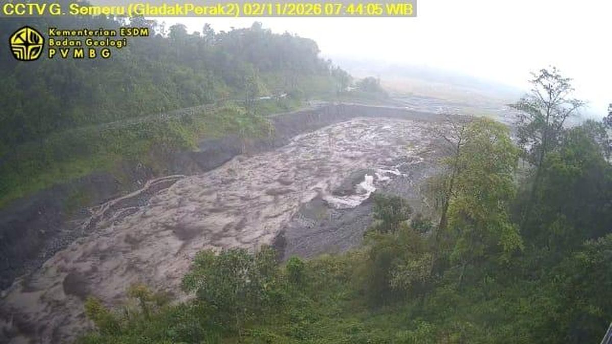
A cold lava flood from Mount Semeru hit Lumajang regency, East Java, on Monday (2 November). The volcanic material overflowed and inundated residential areas on the volcano’s slopes.
Three sub-districts have been identified as the worst affected: Jatiroto, Pronojiwo and Tempursari.
M Rokhim, a resident of Tempursari, said water carrying volcanic material flooded roads and entered homes.
“Low-lying residential areas are already full of water, but the higher ground is safe,” Rokhim told CNNIndonesia.com.
The East Java Regional Disaster Management Agency (BPBD) is continuing to monitor the movement of the cold lava flood. Satriyo Nurseno, head of the agency’s Emergency and Logistics Division, said the main impact was concentrated around a border area.
“The incident occurred along the Glidik River, or Kali Manjing, specifically at the border bridge connecting Malang and Lumajang regencies in East Java. The affected area is being monitored in Tempursari,” Satriyo said.
The Centre for Volcanology and Geological Hazard Mitigation (PVMBG) said the flood was triggered by heavy rainfall near Semeru’s summit. Heavy rain began around the volcano at about 11.40pm on Sunday (1 November).
“Monitoring equipment recorded flood tremors for six hours, with a maximum amplitude of 65 millimetres between midnight and 6am. Mount Semeru remains at Level III, or Alert,” said Agastya Rajendra, an officer at the PVMBG’s Semeru observation post.
Agastya warned that rainwater could carry deposits of volcanic material down rivers originating on Semeru, creating deadly lahars. These rivers include Besuk Kobokan, Besuk Bang, Besuk Kembar and Besuk Sat, as well as their tributaries. The conditions pose a serious danger to sand miners, material-transport drivers and nearby residents.
“Sand miners and people along the rivers are urged to stop their activities immediately and move away from the river channels and banks to a safe place. Residents must comply with activity restrictions, particularly along Besuk Kobokan up to 13 kilometres from the summit,” Agastya said.
The PVMBG also said that, beyond the 13-kilometre radius, all activity must cease within 500 metres of riverbanks. The restriction is necessary because hot ash clouds and lahars could extend as far as 17 kilometres from Semeru’s summit.
“Residents must comply with activity restrictions, particularly along Besuk Kobokan up to 13 kilometres from the summit. Beyond that distance, activity must be halted within 500 metres of riverbanks because hot ash clouds and lahars could extend as far as 17 kilometres from the summit,” he said.
Source: jawawa.id (https://jawawa.id/newsitem/semeru-cold-lava-flood-sweeps-through-homes-in-lumajang-1793598671)
Originally published by CNN Indonesia (https://www.cnnindonesia.com/nasional/20261102112031-20-1422216/banjir-lahar-dingin-semeru-terjang-permukiman-warga-di-lumajang), translated from Indonesian