
Satellite Images Reveal Devastation of Saudi Oil Pipeline Amid Crisis Alert
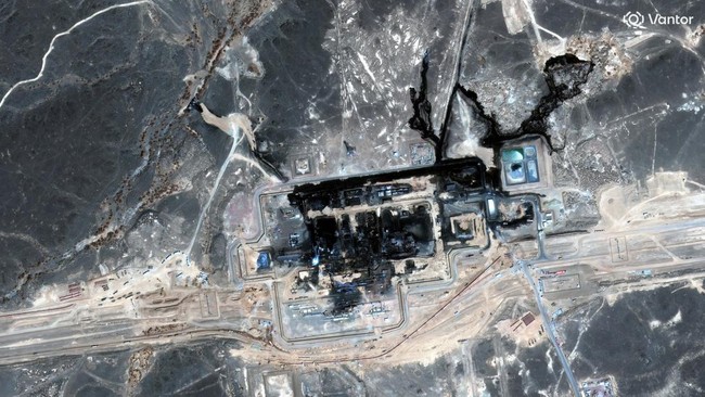
Satellite imagery shows the route of Saudi Arabia’s East-West pipeline stretching across the Arabian Peninsula following a devastating attack over the weekend.
The Saudi government announced that it was forced to shut the key oil artery after a drone strike launched from within Iraqi territory on Friday. Local authorities said the deadly attack caused a number of casualties and damage to facilities.
Citing Reuters on Tuesday (15/9), no group has so far claimed responsibility. However, US President Donald Trump swiftly pointed to Iran-backed proxy groups in Iraq as the masterminds behind the attack. In response, the Iranian foreign ministry firmly denied the accusation on Monday.
The forced closure carries serious consequences. The East-West pipeline, which runs to the port of Yanbu on the Red Sea, is crucial for diverting millions of barrels of Saudi crude away from the conflict zone of the Persian Gulf.
According to a Capital Economics note published on Monday, the pipeline closure could cut as much as 4% of total global oil supply. An operational shutdown that could last weeks is seen as further squeezing an already tense global oil market.
Source: jawawa.id (https://jawawa.id/newsitem/satellite-images-reveal-devastation-of-saudi-oil-pipeline-amid-crisis-alert-1789476797)
Originally published by CNBC Indonesia (https://www.cnbcindonesia.com/news/20260915105550-7-767971/siaga-krisis-citra-satelit-pipa-minyak-saudi-hancur-dibombardir), translated from Indonesian