
Satellite Images Reveal Crater Traces at US Pilot Evacuation Site in Iran
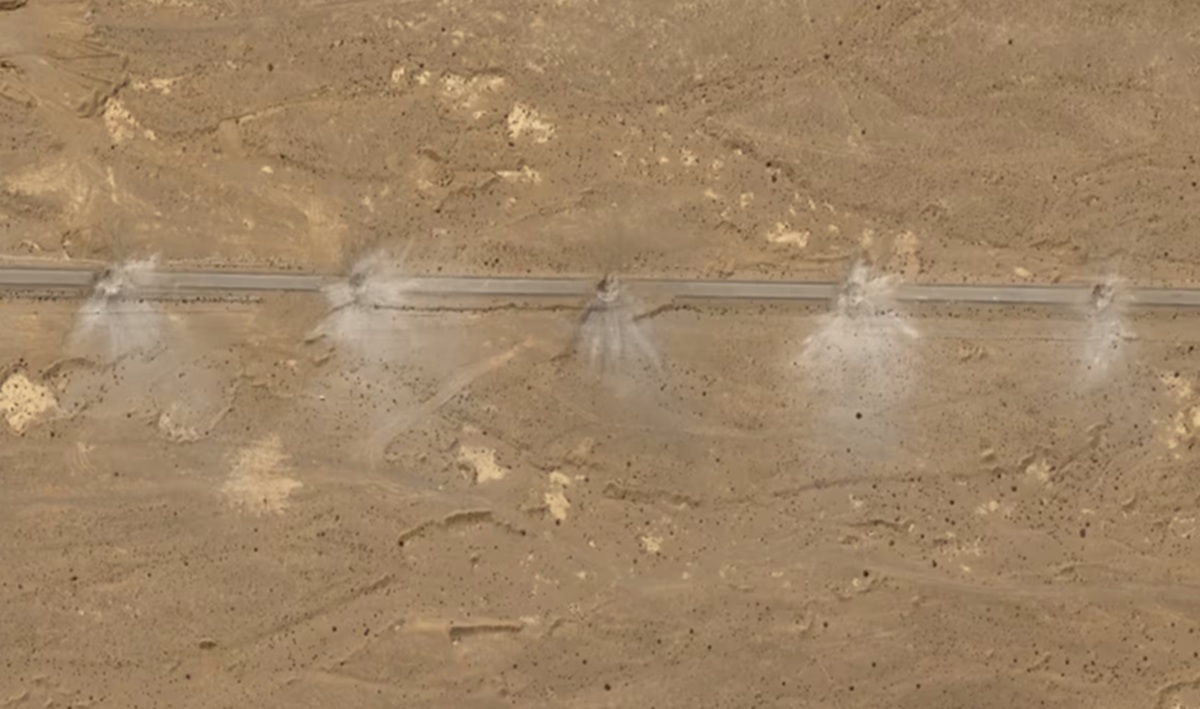
New satellite images from Airbus reveal physical evidence of the dramatic evacuation operation for a United States pilot in Iranian territory. The photographs show a series of large craters along roads in central Esfahan Province, the location serving as the pickup point for the crew of a downed fighter jet last Sunday.
Based on satellite image analysis, at least 18 craters are visible on several road sections. This site is approximately 20 kilometres from a remote runway, where US forces previously destroyed their own aircraft due to damage sustained during the rescue mission.
The craters appear sequentially along the road surface, each with a width of about 9 metres. This size is considered precise enough to sever access on what is suspected to be a planned attack target.
Iranian Forces’ Obstruction Strategy
Previous CNN reports indicated that as US special operations forces moved towards the mountainside where the pilot was hiding, US aircraft conducted a series of airstrikes in the area. This step was taken to ensure Iranian forces could not reach the officer’s hiding location first.
In addition to the craters on the main road, the satellite images dated 5 April also show a circular crater in the area where debris from the F-15E Strike Eagle fighter jet was found last Friday. According to analysis, the crater has a width of about 40 feet (12 metres). Near the crater, two white vehicles and several people standing around them are visible.
Although the exact cause of the crater has not been confirmed, in military protocols, the destruction of a fighter jet crash site is commonplace. This is intended to prevent sensitive equipment or technology from falling into enemy hands.
Location Verification
The crater site is monitored approximately 30 kilometres northwest of the location where US forces destroyed their own aircraft during the rescue operation on Sunday.
The initial crash site was identified by Obretix, an independent researcher. The accuracy of this data was confirmed by matching the mountain terrain in the background of images released by Iranian state media with the latest satellite images. To date, the area in central Iran remains a focal point of international monitoring following the high-risk rescue operation.