
SAR Search for Journalists Expanded to 8,509 Square Nautical Miles on Day 10
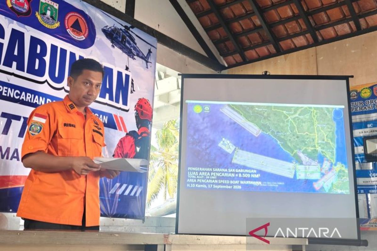
Pandeglang, Banten - Basarnas has significantly expanded the search area for the group of journalists and crew of the fast boat KM Arupadatu I, which lost contact in the Sunda Strait, to 8,509 square nautical miles on the tenth day, Thursday. This is a substantial increase from the 3,439 square nautical miles covered on the ninth day.
Rizky Dwianto, Head of Operations at the Banten SAR Office, speaking from the Main Joint SAR Post in Carita Beach, Pandeglang, stated that the expansion on day 10—the third day of the extended SAR operation—divides the search into 10 main sectors to increase the likelihood of locating the missing persons.
“The area has been expanded to 8,509 square nautical miles, deploying a total of 24 joint vessels across 10 sectors,” he said. The SAR operation involves a total of 523 joint personnel.
According to the Basarnas operational map, the largest search area is Sector C, covering 3,380 square nautical miles, being swept by KRI Leuser and KRI Dewa Kembar, extending into the Indian Ocean waters west of Belimbing Island towards the south of Enggano Island, Bengkulu.
Meanwhile, Sector A, covering 1,156 square nautical miles, is being monitored by KN 213 Bengkulu in the waters west of Sumatra; Sector B (494 NM) by RIB 020 around Enggano Island; and Sector D (637 NM) by KRI Teluk Gilimanuk and KN SAR Antasena from the northwest of Panaitan Island towards the entrance of the Indian Ocean.
In the Lampung waters, Sector E (542 NM) is being searched by KRI Kerambit south of Semangka Bay; Sector F (484 NM) by KN SAR Basudewa around Tabuan Island; and Sector G (316 NM) is being monitored by RIB 02 Lampung, KRI Lepu, and KAL Pahawang in the waters of Mount Anak Krakatau and Sebesi Island.
In the Banten region, Sector H (589 NM) is being searched by KN SAR Tetuka along with five other vessels from south of Anak Krakatau to Panaitan Island; Sector I (397 NM) covers the coast from Anyer and Carita to Sumur; and Sector J (114 NM) monitors the waters from Anyer to Merak.
In addition to the sea search, the joint SAR team is coordinating intensively with the Vessel Traffic Service (VTS) and relevant stakeholders to tighten e-broadcast monitoring for all vessels traversing the Sunda Strait.
Rizky added that the operation is highly dependent on the activity of Mount Anak Krakatau and weather conditions, which, according to analysis by the Meteorology, Climatology, and Geophysics Agency (BMKG), are reported to be fluctuating. Weather is expected to be cloudy with wave heights of 0.5 to 3.5 metres and winds of 10 to 20 knots. Meanwhile, the Centre for Volcanology and Geological Disaster Mitigation (PVMBG) reported that Mount Anak Krakatau is at Level III (Alert) status, accompanied by shallow volcanic earthquake activity.
“All areas divided into these 10 sectors cover regions where the movement of the vessel or the persons on board (POB) we are searching for could occur; there is no specific single point. We hope the weather will be supportive,” he said.
Source: jawawa.id (https://jawawa.id/newsitem/sar-search-for-journalists-expanded-to-8-509-square-nautical-miles-on-day-10-1789610421)
Originally published by Antara (Indonesian) (https://www.antaranews.com/berita/5744947/sar-jurnalis-hari-ke-10-kian-diperluas-hingga-8509-nm-persegi), translated from Indonesian