
Rain Clouds Set to Increase Over Kalimantan and Sumatra
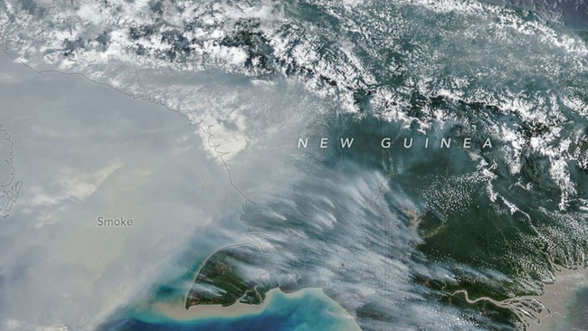
Jakarta — The potential for rain-cloud formation in South Sumatra and Central Kalimantan is high. The head of the Meteorology, Climatology and Geophysics Agency (BMKG), Teuku Faisal Fathani, said this was expected to continue for at least the next five days.
“In Central Kalimantan, the potential for cloud formation is high from today through the next five days. In South Sumatra, it will be high from tomorrow and for the following five days,” Faisal said on Monday (27 October 2026).
He said the phenomenon was linked to BMKG’s weather-modification operations, which are being conducted in several areas with a high number of hotspots.
The operations combine dry ice and salt (NaCl) to help tackle forest and land fires. Faisal said the effort was being carried out on a large scale at the President’s direction.
“We are also using Hercules and CN-295 aircraft, as well as other aircraft owned by the Indonesian military,” he said.
Previously, heavy rain was reported in areas including South Sumatra, Central Kalimantan and South Kalimantan following the weather-modification operations and the use of dry ice and NaCl.
Faisal said weather modification and dry ice were being used to reduce the concentration of smoke by breaking up the inversion layer that traps smoke below an altitude of 6,000–7,000 feet.
Once the smoke rises, sunlight triggers evaporation and rain clouds form. BMKG then seeds the clouds with NaCl.
Faisal also said that parts of Indonesia would enter the rainy season in November and December. The season is expected to peak from December to February, and people should prepare for it; the agency said conditions would be normal.
He added that the rainy season was expected to begin an average of 20–30 days later than usual across Indonesia, due to the influence of El Niño.