
Probolinggo Disaster Agency Remaps Evacuation Routes after Bromo Eruption
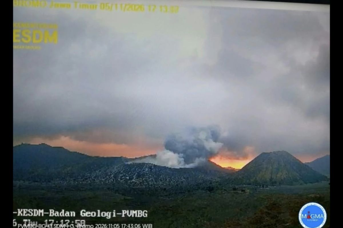
Probolinggo, East Java (ANTARA) – The Probolinggo Regional Disaster Management Agency (BPBD) has remapped evacuation routes and locations for temporary shelters following the eruption of Mount Bromo on Thursday (5 November) evening.
“Today, together with the Indonesian Military and National Police, we are remapping evacuation routes and shelter locations as a mitigation measure in case Mount Bromo erupts again,” Probolinggo BPBD Executive Head Oemar Sjarif said by telephone on Friday.
Mount Bromo erupted at 5.11 pm Western Indonesia Time on Thursday (5 November), with the ash column observed at about 500 metres above the summit, or 2,829 metres above sea level. According to officials’ records, Mount Bromo, which is 2,329 metres above sea level, last erupted on 19 July 2019, when no eruption was visually observed.
“The Probolinggo BPBD continues to coordinate with various cross-sectoral parties to monitor Mount Bromo’s activity, including the Bromo Volcano Observation Post and the Bromo Tengger Semeru National Park Agency, which manages the tourist area,” he said.
He said volcanic activity recorded by surveillance cameras on Friday morning remained stable at Level II, or Alert, although officials continued to monitor developments.
Seismic monitoring over the 24-hour period on Thursday recorded one eruption earthquake, with an amplitude of 23 millimetres and a duration of 46 seconds; four low-frequency earthquakes, with an amplitude of 1 millimetre and durations of 10–11 seconds; six hybrid or multi-phase earthquakes, with an amplitude of 1 millimetre, no observed S–P interval and durations of 5–10 seconds; and one continuous tremor, with an amplitude of 0.5–1 millimetre, predominantly 0.5 millimetres.
Visually, Mount Bromo was clear at times and at others obscured by fog ranging from levels 0 to III. Thin to thick white and grey smoke was observed rising 50–500 metres above the summit from the main crater. The weather was clear to cloudy, with light winds blowing west and north-west.
Oemar said Mount Bromo remained at Level II, or Alert. The Centre for Volcanology and Geological Hazard Mitigation (PVMBG) has advised residents around the volcano, as well as visitors, tourists and climbers, not to enter the area within a one-kilometre radius of the active crater.
Source: jawawa.id (https://jawawa.id/newsitem/probolinggo-disaster-agency-remaps-evacuation-routes-after-bromo-eruption-1793929891)
Originally published by Antara (Indonesian) (https://www.antaranews.com/berita/5835627/bpbd-probolinggo-petakan-kembali-jalur-evakuasi-pascaerupsi-bromo), translated from Indonesian