Perhutani Maps High-Risk Fire Points Ahead of Extreme Dry Season in Lembang Forest Area
REPUBLIKA.CO.ID, WEST BANDUNG – Perum Perhutani’s Forest Management Unit (BKPH) Lembang has mapped high-risk points for forest and land fires (karhutla) in its area ahead of the extreme dry season caused by the El Niño phenomenon, as predicted by the Meteorology, Climatology, and Geophysics Agency (BMKG).
The Assistant Forester (Asper) of BKPH Lembang, Cucu Supriatna, stated that the total area of Lembang spans 4,100 hectares, divided into three Forest Management Resorts (RPH): RPH Lembang, RPH Cisarua, and RPH Cikole. The identification results show that the high-risk fire points are located along the border between Cisarua and Lembang.
“The Lembang area covers 4,100 hectares from Cisarua to Cikole. In my area, the mapping of high-risk fire points is in the Cisarua and Lembang regions, but their position is along the border,” said Asep when contacted on Tuesday (21/4/2026).
He explained that the border area between Cisarua and Lembang forests is prone to fires due to the abundance of alang-alang grass that easily ignites during prolonged dry seasons often accompanied by strong winds. This situation is worsened by human behaviour.
“In recent years, incidents frequently occur in the Cisarua-Lembang border area. From identification, people often hunt birds and make small fires to heat water. They think the fire is out, but it’s not. Then they leave it, and with the hot dry weather plus wind, it triggers fires,” he revealed.
Furthermore, he said, that area is not used for agroforestry or tapping, so it is rarely visited by farmers. The presence of farmers greatly assists in supervision. This differs from other areas in the BKPH Lembang forest, which are planted with crops like coffee and others.
“Indeed, in the border area, it’s dominated by alang-alang, which dries out, and such uncultivated land is indeed harder to monitor,” he stated.
Meanwhile, for anticipation and handling, Perhutani is collaborating with the Forest Police (Polhutan), farmers especially those in the Forest Village Community Institution (LMDH), and the sub-district leadership communication forum (Forkopimcam). “We also have appeals by installing warning signs, which have already been put up. Ahead of the dry season, they will be increased. Direct socialisation is usually given to LMDH and the community, especially those working the land,” he added.
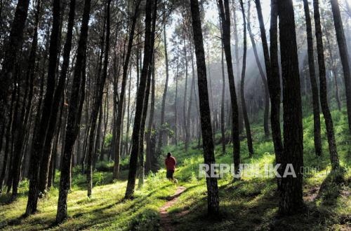
Asep continued that overall, the forest canopy in the BKPH Lembang area is still well maintained, dominated by pine trees and other green areas. “The land cover from Cisarua to Lembang is indeed still good,” said Asep.