
Pekanbaru Air Quality Reaches Hazardous Level
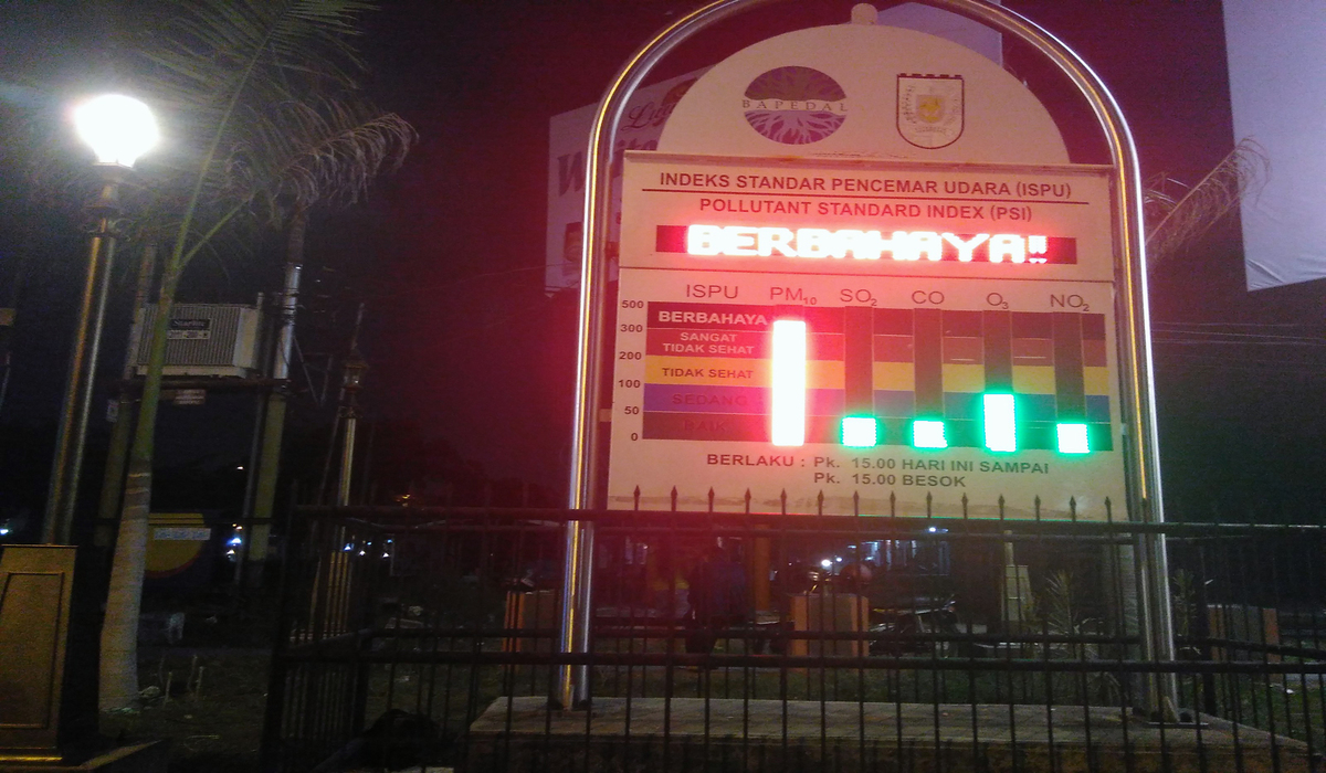
Air quality in Pekanbaru, Riau, continues to worsen, reaching hazardous levels due to forest and land fires (karhutla). The air pollution level for particulate matter PM2.5 stood at 318.0 micrograms per cubic metre (µg/m³), classified as hazardous, since 8.00 pm Western Indonesia Time on Monday (24/8).
This is based on the PM2.5 particulate matter history graph released from the official BMKG website. Throughout the day, air quality in Pekanbaru City had also deteriorated to the Very Unhealthy level.
“Tonight Pekanbaru is very frightening. The atmosphere is truly tense, full of thick smoke haze from the forest and land fires. We feel as if we are choking and struggling to breathe because everything (indoors and outdoors) already smells of smoke,” said Yola, a Pekanbaru resident, on Monday (24/8) evening.
The streets of Pekanbaru City, which are usually busy at night, have become somewhat quiet. Most residents prefer to stay indoors rather than engage in outdoor activities. However, night food vendors continue to trade as usual.
Okto Yugo Setiyo, Coordinator of the Riau Forest Rescue Network (Jikalahari), said President Prabowo Subianto should check on the public directly.
“He should check the performance of his subordinates and not be too quick to simply trust their reports. The fact is that over the past week, hotspots have actually increased,” said Okto.
Referring to the IQAir website over the past two weeks, from 10 to 24 August 2026, the Air Pollutant Standard Index (ISPU) in Riau has been at unhealthy to very unhealthy levels due to smoke pollution. On 24 August 2026, the ISPU stood at 256, in the very unhealthy category.
“The Acting Governor has not done anything to guarantee the safety of victims, even though residents affected by smoke pollution and suffering from acute respiratory infections (ISPA) continue to increase, reaching 376 cases in August 2026 alone,” said Okto.
The poor air quality is in line with the high number of hotspots and Jikalahari’s field findings. Jikalahari’s analysis using Suomi NPP–VIIRS satellite imagery for the period January–August 2026 detected 4,492 hotspots in Riau, and in August alone, hotspots reached 1,083. Of the total, 3,330 points, or 74 per cent, were located on peatland. A total of 875 hotspots, or 19.4 per cent, were within company concession areas, consisting of 214 hotspots in industrial timber plantation (HTI) concessions and 661 hotspots in oil palm plantations.
Jikalahari’s field findings from 1 to 24 August 2026 show that burned land is suspected to be located in five concessions, namely PT Arara Abadi, PT RAPP Mandau Block, PT Tani Subur Makmur, PT Sari Lembah Subur, and PT Teguh Karsa Wana Lestari, with a total area of approximately 583 hectares.
“It is a shame if the President only comes as far as a meeting to listen to reports. A direct field review should be an important step to take,” he concluded.