
NTT earthquake: Geology Agency urges residents to follow evacuation routes
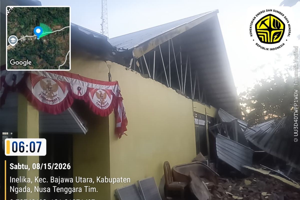
The Geology Agency of the Ministry of Energy and Mineral Resources (ESDM) has asked the public to remain calm and alert, follow the instructions of the local Regional Disaster Management Agency (BPBD), check the condition of buildings, and comply with evacuation signs and routes following the earthquake centred northeast of Nagekeo, East Nusa Tenggara (NTT).
Head of the Geology Agency of the Ministry of ESDM Lana Saria, in a statement in Jakarta on Saturday, said the public is also urged not to be easily influenced by unaccountable information regarding the earthquake and tsunami.
Vigilance against possible aftershocks must be maintained, while residents are advised to avoid cliff areas that have the potential for ground movement, especially during rainy conditions.
On Saturday at 04.58.23 WIB, an earthquake shook and was felt by people in various regions of NTT to NTB, Bali and South Sulawesi.
Based on data from the Meteorology, Climatology and Geophysics Agency (BMKG), the epicentre was located at coordinates 8.33 South Latitude - 121.32 East Longitude in Northeast Nagekeo, NTT, with an initial magnitude of M7.0 and a depth of 10 kilometres.
The earthquake parameters were then updated to M7.7 with a depth of 15 kilometres.
Data from GeoForschungsZentrum (GFZ) recorded the epicentre at coordinates 8.375 South Latitude - 121.545 East Longitude with a magnitude of M6.25 at a depth of 10 kilometres.
Lana Saria explained that the epicentre location is at sea.
The nearest area has diverse morphology, ranging from plains, undulating, rolling, hills, to mountains.
The region is composed of Tertiary-aged volcanic rocks and Quaternary-aged sedimentary rocks.
These geological conditions are one of the factors that need to be considered in understanding the strength of shaking at the surface.
“Rocks that have undergone weathering and surface sediments have the potential to amplify earthquake shaking,” said Lana Saria.
Based on local site Vs30 data, the area around the epicentre is classified as Soil Class C or very dense soil/soft rock, Soil Class D or medium soil, and Soil Class E, namely soft soil.
“The presence of these softer soil classes means the potential for earthquake shaking in the area is felt more intensely,” added Lana.
Based on source parameters, the earthquake has a thrust fault mechanism associated with the Flores Back Arc Thrust Fault Zone.
The Geology Agency stated that the area is within a medium to high earthquake disaster-prone zone.
Based on BMKG information, shaking intensity was recorded at IV-V MMI in Ruteng, V MMI in Bima City and Dompu Regency, and IV-V MMI in Ende, Labuan Bajo, Maumere and East Sumba.