NTB Still Drenched in Rain as El Niño Strengthens
The Meteorology, Climatology and Geophysics Agency (BMKG) predicts that most parts of West Nusa Tenggara (NTB) are still at risk of being drenched by rain even as the El Niño phenomenon begins to strengthen toward moderate by the end of May 2026.
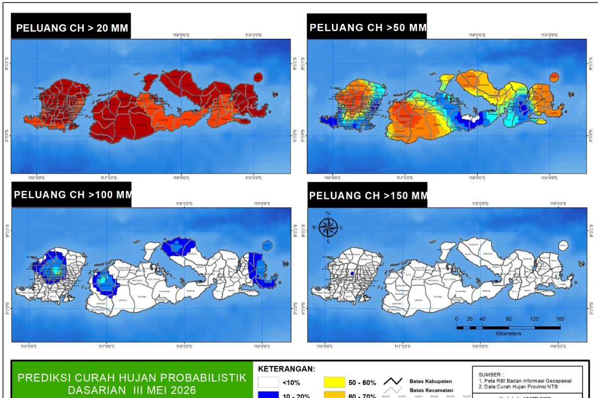
From 21-31 May, there is a 50 to 80 percent chance of rainfall with an intensity exceeding 50 millimetres per dasarian (ten-day period) occurring across almost all NTB, said forecaster Nindya Kirana of the BMKG NTB Climatic Station in Mataram on Thursday.
Moreover, rainfall with intensity exceeding 100 millimetres per dasarian is predicted to occur at a 10 to 40 percent probability in parts of West Lombok, Central Lombok, North Lombok, East Lombok, West Sumbawa, and Bima.
BMKG notes that the Indian Ocean Dipole (IOD) is currently in a neutral category with an index of -0.099 and is predicted to be in a positive state starting July 2026.
Nindya said that the air mass flow over much of Indonesia is currently dominated by easterly winds. Bends and junctions of winds are visible near the equatorial region.
Sea surface temperature anomalies across much of Indonesian waters are in normal to warm conditions. The MJO is active in phase 2 of the Indian Ocean, and is predicted to gradually become inactive.
“Spatially, several atmospheric waves are predicted to be active in Indonesia from mid-May 2026,” Nindya said.
BMKG analysis results indicate that although some parts of NTB are entering the dry season, other areas remain in a transition phase from the rainy season to the dry season.
Consecutive dry days are generally still classified as very short to medium. The longest dry spell recorded was 19 days at the Dongo Rain Station in Bima Regency.
“We urge the public to make use of the rain that is still occurring to anticipate the drought that typically occurs in the dry season,” Nindya concluded.