
North Sumatra Once Again Blanketed by Smoke from Fires Elsewhere
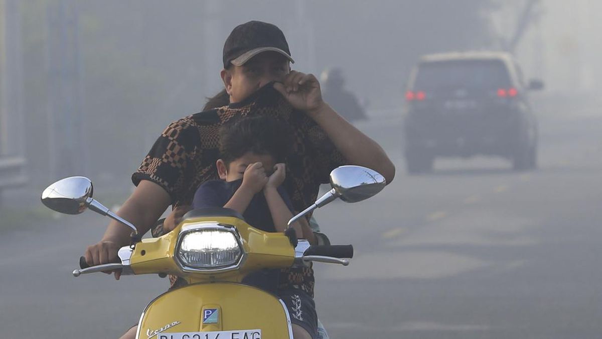
All areas of North Sumatra were once again blanketed by smoke from forest and land fires carried from Kalimantan and South Sumatra on Wednesday (21 October).
Hendro Nugroho, head of the Meteorology, Climatology and Geophysics Agency’s (BMKG) Region I Centre in Medan, said satellite monitoring of hotspots over the 24 hours to 20 October 2026 detected no moderate-category hotspots in the province.
“However, satellite monitoring of smoke distribution across Sumatra on 21 October 2026 at 10am WIB detected smoke across all of North Sumatra. Wind analysis shows winds blowing from the east-south-east towards the north-west and north,” he said.
He said the wind pattern indicated that smoke in North Sumatra had been carried from southern Sumatra and Kalimantan. “However, determining the precise source of the smoke requires further analysis, taking into account atmospheric dynamics and other supporting data,” Hendro explained.
He added that air-quality monitoring on 21 October 2026 showed moderate conditions in several parts of North Sumatra.
“Observations by Silangit Meteorological Station and Aek Godang Meteorological Station at 10am WIB on 21 October also showed visibility reduced to between one and five kilometres. This is forecast to continue for the next three days,” Hendro said.
Residents in areas with low visibility because of haze and smoke were advised to take care when driving, reduce their speed, keep a safe distance and use vehicle lights as needed.
“People are also advised to reduce outdoor activities if air quality deteriorates and to wear an appropriate mask to reduce exposure to smoke particles,” he said.
The agency also urged regional leaders to coordinate with the local Disaster Management Agency (BPBD), Indonesian Military (TNI) and National Police (Polri) to anticipate the effects of the smoke and strengthen public preparedness.