
New Map Featuring True Size of Africa Adopted by UN
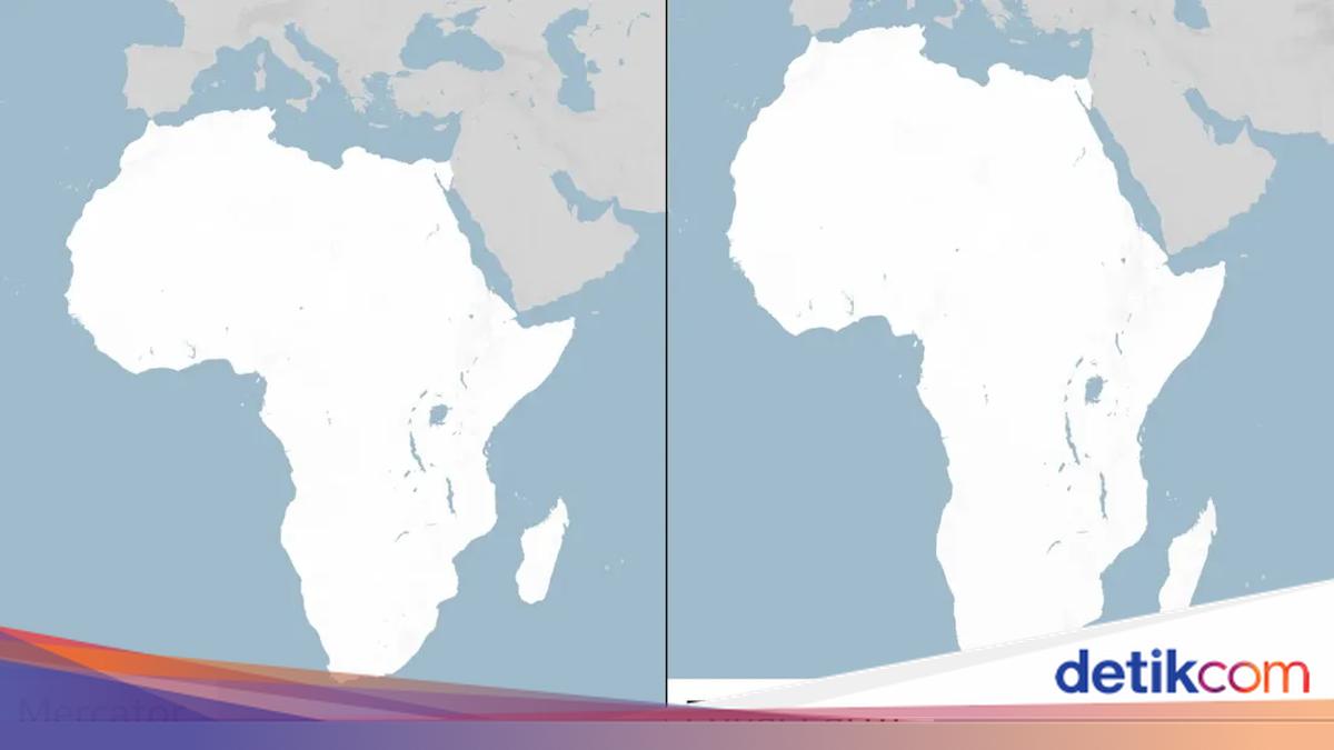
The United Nations General Assembly has chosen to replace the traditional world map with a more accurate version that reflects the true size of the African continent. Under this new map, Africa appears significantly larger, while North America and Europe appear smaller.
The ‘Map Correction’ resolution was supported by member states of the African Union (AU) and approved by 164 countries. France and the United Kingdom were among the nations in favour of the change, which was championed by Togo.
The United States was the only country to oppose the resolution, while six other nations chose to abstain. Although the UN vote is not legally binding, it is expected to alter the maps used by various international institutions worldwide.
Criticism of the Mercator Map
The Mercator projection has been widely used since the 16th century. It was designed in 1569 by Flemish cartographer Gerardus Mercator to assist European explorers in navigating the globe.
However, the map has faced criticism for depicting Africa as being comparable in size to Greenland, despite Africa being 14 times larger. Critics argue that this distortion leads to the developmental needs and potential of equatorial nations being overlooked.
The distortion in the Mercator map is a result of the impossibility of accurately representing a spherical globe on a two-dimensional plane. Every world map requires some form of compromise. The Mercator projection represents the Earth’s curvature by making countries near the equator appear smaller than they are, while countries closer to the poles appear larger.
In an effort to correct this, a team of cartographers created an equal-area map in 2018 known as the ‘Equal Earth’ projection. In February, 54 African Union member states adopted it, stating that the map ‘more accurately represents the size of all continents, especially Africa.’
The ‘Map Correction’ Resolution
The online campaign group #CorrectTheMap stated: ‘You could fit the United States, China, India, Japan, Mexico, and most of Europe into Africa, and still have plenty of land left over.’
Ahead of Friday’s vote, Togo’s Foreign Minister, Robert Dussey, told Reuters: ‘A fair world begins with a fair map.’
During a presentation at the UN, the group asserted: ‘A map is never neutral. Maps shape perception and influence how societies and continents are understood in the world.’
They received support from the French Minister for Europe and Foreign Affairs, Jean-Noël Barrot, who stated his ministry would cease using the Mercator map. ‘Changing the map certainly does not change the world. But correcting the representation that distorts it is an act of truth,’ he remarked.
Lerato Mogoatlhe, a member of Africa No Filter, revealed the reasoning behind the campaign to move away from the Mercator projection. She stated that this is part of an effort to stop the ‘world’s longest-running misinformation and disinformation’ regarding Africa. ‘The misrepresentation of Africa on the world map is not merely a cartographic error—it is a matter of narrative,’ Mogoatlhe told the BBC.
For Kenyan geographer Kioko Muendo, the Mercator map implicitly diminishes the abundant resources, population, and investment opportunities within the African continent. ‘A map is more than just a guide for travellers—maps shape how regions are viewed politically and economically,’ said Muendo.
US Rejection
However, Yaryna Ferencevych, a US representative to the UN, argued that the resolution mocks the work and purpose of the UN General Assembly. ‘Instead of focusing on real issues of international peace, prosperity, or goodwill, this body is debating 16th-century map projects and their role in promoting reparations and “cognitive justice,”’ she said.
In March, the US also issued criticism when a resolution was adopted declaring the transatlantic slave trade as a ‘crime against humanity.’