
New Landmass Emerges Near Mount Anak Krakatau
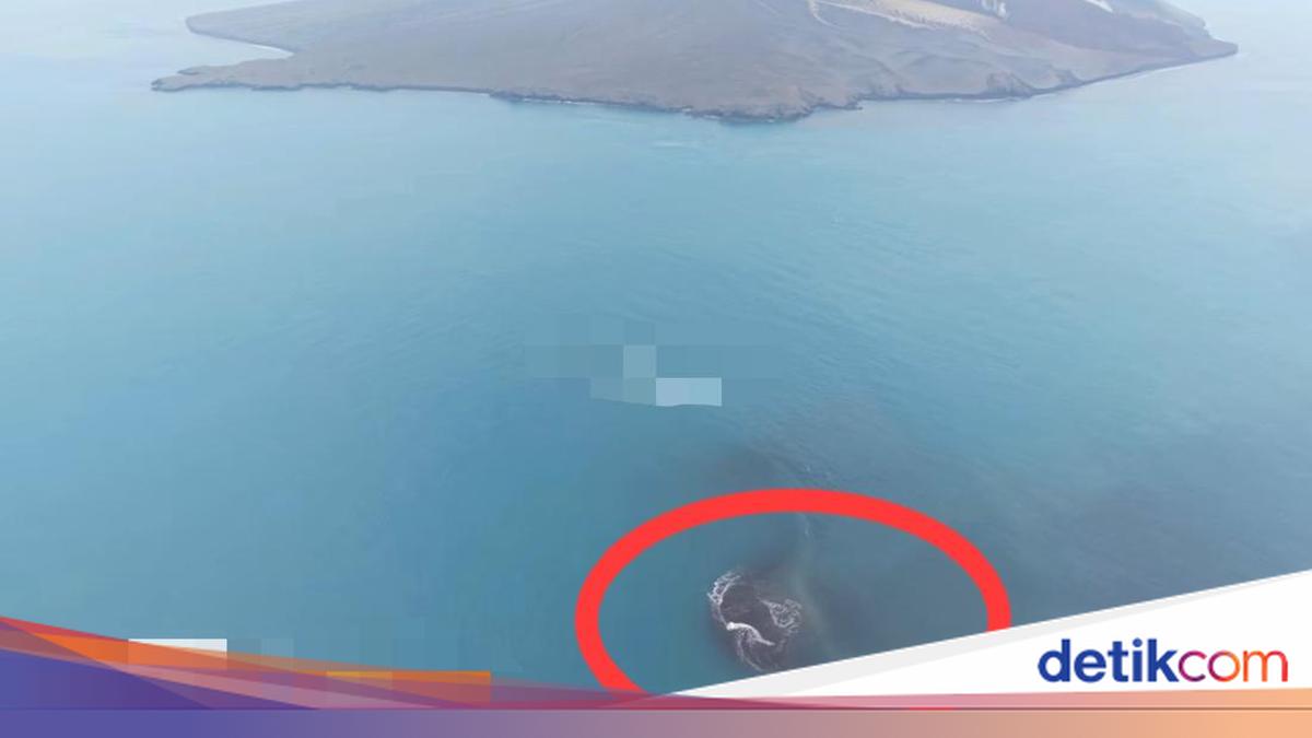
New land has appeared around Mount Anak Krakatau in the Sunda Strait following an eruption that occurred some time ago. The Geological Agency of the Ministry of Energy and Mineral Resources has revealed that the new landmass covers an area of 32.8 hectares.
“The Geological Agency has calculated an increase in area of 3ally 32.8 ha,” said the Head of PVMBG, Geological Agency of the Ministry of Energy and Mineral Resources, SS Rita Susilawati, via the Geological Agency’s social media page on Thursday (24/09/2026).
The emergence of this new land is located between Anak Krakatau Island and Sertung Island in the Sunda Strait. This has also been confirmed by the Head of the Anak Krakatau Volcano Monitoring Post. To provide perspective, the 32.8-hectare area is almost as large as the Prambanan Temple complex, which covers 39.8 hectares.
Geological Agency Analysis
Meanwhile, the emergence of the new land is the result of deposits from the eruption of Mount Anak Krakatau.
The Geological Agency presented evaluation results based on Sentinel satellite imagery, showing an increase in land on the body of Mount Anak Krakatau in the north-west to south-west sector. This is a consequence of the deposition of pyroclastic material and lava flows resulting from continuous eruptions between 4-6 September 2026.
Furthermore, based on Sentinel imagery, small island mounds were detected to the north-west and south-east of the Mount Anak Krakatau body. According to the Geological Agency, this large landmass is suspected to be part of the eruption deposits from Mount Anak Krakatau.
“The emergence of these ‘two islands’ is suspected to be related to continuous eruptions lasting approximately 25 hours,” said Rita.
According to the Geological Agency’s preliminary interpretation, thin magma exiting during the eruption reached the surface through an elongated opening from the north-west to the south-east, causing eruption materials to form land in other locations, visible in the form of two mounds resembling islands.
“However, once again, this is still a suspicion that needs to be confirmed through field inspections. The Geological Agency will compare satellite imagery from before and after the eruption and conduct field verification,” she added.
Regarding the emergence of this new land, the Geological Agency has urged residents to remain calm. The status of Mount Anak Krakatau is currently at ‘Alert’ (Waspada), with a recommended danger zone within a 2 km radius of the eruption centre.
“For safety, the public is also advised not to approach within a 1 km radius of the location of the two island mounds visible near Mount Anak Krakatau,” she added.
Source: jawawa.id (https://jawawa.id/newsitem/new-landmass-emerges-near-mount-anak-krakatau-1790222546)
Originally published by detikcom (https://news.detik.com/berita/d-8676705/seluas-ini-daratan-baru-muncul-di-dekat-gunung-anak-krakatau), translated from Indonesian